 | The Xenophile Historian |

 |
 |
 |
 |
 |
 |
 |
 |
 |
 |
 |
 |
 |
 |
A History of the South Pacific
Chapter 2: Terra Australis Incognita
1500 to 1781
Demographics at the Time of the European Arrival
Oceania has never been very crowded; today it has 39.5 million people, only 0.56 percent of the world's population. That's one out of 178 people in the world community. What's more, all but three million of them live in just three nations: Australia, Papua New Guinea, and New Zealand. For the time period covered by this chapter, the sixteenth to the eighteenth century A.D., there were probably no more than 2.5 million people for the whole region.
The reason for the sparse population is easy to figure out; most of the region is ocean and small islands, not feasible for large communities. Of course the Aborigines had a whole continent, but as we noted before, they did not even practice agriculture, so they could not exploit their resources effectively. When Europeans contacted them, there were probably 200,000 natives in Australia -- 300,000 at most -- and 5,000 in Tasmania. It looks like the population of Melanesia was eight times as high, or 1.6 million, simply because the Melanesians did some farming.
As for the Polynesians, we are guessing they numbered somewhat over half a million. Although most of the islands they settled were small ones, their superb sailing skills allowed them to reach more places than the other ethnic groups.(1) Since no census data exists for the South Pacific before the nineteenth century, we will guess that the largest size of the Polynesian communities was 200,000 on the Hawaiian Islands, 200,000 on New Zealand, 100,000 in the rest of Polynesia (Samoa, Tonga, the Marquesas Islands, Tahiti, etc.), and a few thousand in Micronesia. Of all those areas, New Zealand had the most acreage, so the Maori community would have been much larger if their ancestors had brought crops and animals suitable for that relatively cool climate. Because they didn't, most of the Maori lived on the warmer North Island.
![]()
The Mysterious Southern Continent
"The earth is placed in the central region of the cosmos, standing fast in the center, equidistant from all other parts of the sky . . . . It is divided into three parts, one of which is called Asia, the second Europe, the third Africa . . . . Apart from these three parts of the world there exists a fourth part, beyond the ocean, which is unknown to us."--Isidore of Seville, Etymologies (circa 600 A.D.)
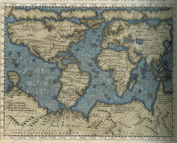
Once Europeans accepted the idea that the world was round, they started drawing maps that showed four continents: Europe, Africa, Asia, and a huge mass taking up most of the southern hemisphere, called Terra Australis Incognita.(2) The belief in the mysterious fourth continent had been around since Claudius Ptolemy drew a map which showed it, in the second century A.D. He taught that there had to be at least as much land south of the equator as there is north of it, to keep the world from tipping upside down, and called this land the Antipodes, or "balancing feet." For the rest of ancient and medieval times, those who believed in Terra Australis Incognita thought it was totally inaccessible; if the lands around the equator were too hot for any man to cross, they reasoned, then the southern hemisphere must be the home of monsters rather than men. This idea was dispelled when the Portuguese and other Europeans crossed the equator, to be replaced by speculation about what kind of inhabitants and wealth the fourth continent might have. Such thinking would continue until the eighteenth century.
European cartographers and writers used their most active imaginations when portraying what the fourth continent must be like. Any fantastic place thought to exist, that did not turn up in the northern hemisphere, slipped down to the unknown south. One such place was Ophir, the legendary source of King Solomon�s gold. Another was the kingdom of Lokak, also spelled Locach or Lucach. Marco Polo talked about Lokak in his travel account, though he never went there himself; he reported that "gold is so plentiful that no one who did not see it could believe it." Lokak was probably an exaggerated description of Siam or Cambodia, so when visitors to those countries did not find them all that rich, Lokak was moved south of the equator as well. The most popular atlas of the day, published by Abraham Ortelius of Antwerp in 1570, showed the coast of Terra Australis running steadily northwest from the Strait of Magellan, until in the vicinity of Asia it encompassed Australia, New Zealand, and New Guinea. In a landmass that big there was plenty of room for an Ophir or a Lokak.
Before they could look for Terra Australis in the Pacific, the earliest explorers had to discover the Pacific. When they began exploring, Europeans thought there was one ocean, not two, separating Europe from Asia. That view began to change when the explorers after Columbus realized that the lands on the western shores of the Atlantic were not part of Asia, but a "New World." This was confirmed in 1513, when Vasco N��ez de Balboa crossed Panama and became the first European since Marco Polo to see the Pacific. However, it wasn't called by that name yet; Balboa had hiked from north to south across the isthmus, and was facing south when the ocean came into view, so he named it the "Southern Sea."
By this time, cartographers could draw the outlines of Old World continents on maps and globes with reasonable accuracy, and were starting to figure out what the recently-discovered Americas looked like. For Terra Australis, its northern boundary was always drawn as being just south of the voyages made to that point. The journey of Vasco da Gama pushed it out of the south Atlantic, and Ferdinand Magellan's trip around the world pushed the presumed boundary below latitude 52� south--but only in the Indian Ocean. Magellan also proved that the Americas could not be part of Terra Australis, though the Americas were just as "Incognita" before 1492. First, the American continents did not extend all the way to the south pole. Second, like the Old World, the New World continents had more land north of the equator than south of it. New Guinea was thought to be the continent's northernmost point in the sixteenth century, because only the northern coast of that island had been seen by Europeans so far. That meant the unknown continent could occupy as much as half of the Pacific, and it only got smaller when a ship's keel passed over a part of it shown on existing maps.
Explorers spent centuries looking for a ghost continent in the Pacific, because of the obstacles that hindered them there. The main obstacle was the prevailing system of winds and currents. Between the equator and latitude 30� south, you have the trade winds, which reliably blow from east to west, but they also tend to push ships northward, so you have to sail against them to explore the southern oceans. South of 30� S, the trade winds are replaced by stronger winds (the "roaring forties," "furious fifties," and "shrieking sixties"), which constantly blow from west to east. Those winds make it difficult to go around Cape Horn and the Cape of Good Hope from the east, and the southern temperate latitudes are only easy to explore if you sail to the Pacific by going through the Indian Ocean first.
Even if they mastered the winds, European explorers had a long way to go. The journey from Europe to the Pacific could take anywhere from five months to fourteen. Because this was before the invention of refrigeration, it was hard to keep food and water fresh for months, and the supply of both eventually ran low. In addition there were debilitating illnesses (especially scurvy, which was caused by a diet without vitamin C), and boredom; when crewmen were sick, tired and bored, they became dangerous. By the time a ship and its crew reached the Pacific, their best days were behind them, leaving little time for exploration before they had to go home.
Finally, there was the challenge of navigating on the open sea. It was easy to determine latitude in the northern hemisphere; the distance in degrees of Polaris, the north star, above the horizon, is always the same as one's latitude. South of the equator it was bit more difficult, because Polaris is not visible and there is no bright "south star" on the south pole of the sky, but navigators learned to steer by southern constellations, too. The big problem in both hemispheres was longitude, which could not be determined with any degree of certainty. This meant that once sailors left familiar land, they never knew for sure how far east or west they were. It also meant that the islands of the Pacific would be discovered more than once and given a new name on each occasion.
By the second decade of the sixteenth century, Portugal had all it could handle in Brazil, Africa and the Far East, so Portuguese exploration stopped. Spain was in a better situation; after it conquered most of the New World, Spanish ports like Acapulco and Lima were built on the Pacific coast. However, these ports were not available for the first Pacific explorer. In 1519 Ferdinand Magellan began his journey; like Christopher Columbus, he was looking for a westward route to the Spice Islands of Asia. By following the South American coast, he found a "southwest passage" through the Americas, what has since been called the Strait of Magellan. One of his five ships was wrecked in a south Atlantic storm, another deserted and returned to Spain when its pilot panicked in the strait, but the remaining three made it to the other side. Because it wasn't stormy like the Atlantic, Magellan named the next body of water the Pacific, or "peaceful" ocean. Unfortunately, the Pacific proved to be much larger than the Atlantic, and the course taken did not take bring them near any major islands like Tahiti, Hawaii or Fiji. By the third month the crew was eating the leather on the rigging and trying to catch the rats in the hold. The men were so sick from scurvy that it took six of them to do the work of one, and between rainstorms the water in their barrels became so foul that they had to hold their noses to get a drink. At last, after 98 days at sea they came to Guam, where they resupplied. There was some trouble because the native tribe, the Chamorros, didn't have the Western concept of private property; they saw the Spaniards taking food and water, so they thought it was all right to board the ships and take whatever interested them, even the lifeboats on the flagship, the Trinidad. Disgusted, Magellan drove them off, called Guam and the nearby islands the Islas de Ladrones (Islands of Thieves), and continued on to the Philippines. In that archipelago Magellan got killed in a feud between two local chiefs. His successor, Juan Sebastian del Cano, burned one ship because there were no longer enough crewmen to handle it, and continued on to the Spice Islands with the other two, the Trinidad and the Victoria. Eventually the Trinidad fell into the hands of the Portuguese, while del Cano made it home with the Victoria, a cargo of cloves and the news that this was not the best way to go to Asia.
The news that Magellan had found the long-sought westward route to Asia persuaded Spain to ignore the losses and try again. The next expedition to cross the Atlantic and Pacific had seven ships, led by Garc�a Jofre de Loa�sa and Sebastian del Cano, and they went forth in 1525. At first their voyage sounded a lot like Magellan's; two ships were wrecked near the entrance of the Strait of Magellan, and a third deserted. Of the remaining four ships, one was carried by the wind and currents to Mexico, one disappeared (wreckage from it was found in 1929, on the Amanu atoll in the Tuamotu archipelago), one was shipwrecked on Mindanao (the big southern island in the Philippines), and only one made it to the Spice Islands; both de Loa�sa and del Cano died before arrival. In 1527 Hernando Cortez, the conqueror of Mexico, was ordered by the Spanish crown to send an expedition across the Pacific, to find out what happened to the 1525 expedition and the Trinidad. Cortez sent three ships under the command of his cousin, �lvaro de Saavedra Cer�n. Again, only one ship made it all the way across the Pacific. In the southern Philippines, Saavedra found and rescued a few survivors who had made their way there; then he continued on to the Spice Islands. Saavedra came to grief, though, when he tried to return to Mexico by going east across the Pacific. In doing so he explored the northern coast of New Guinea(3) and discovered the Admiralty Islands and the Marshall Islands, but the trade winds blew him back to Indonesia every time. On the third attempt, the ship was wrecked in a storm, and Saavedra was killed (1529). The survivors of the expedition gave themselves up to the Portuguese, who detained them for years before allowing them to return to Spain. Not until 1565, the year when Spain began its conquest of the Philippines, did a Spanish ship succeed in crossing the Pacific from west to east.
![]()
Did Spain Discover Hawaii First?
Officially Hawaii was discovered by James Cook (see below), but was Cook really the first European to go there? When Spain established its colony in the Philippines in 1565, it maintained contact through the Manila Galleon trade; one or two ships made a round trip between the Philippines and Mexico every year. Because the part of the Pacific in the tropics has winds blowing from east to west, while the part of the Pacific in the north temperate zone has winds blowing from west to east, ships heading from Acapulco to Manila tended to pass south of the Hawaiian islands, while ships on the return voyage tended to pass on the islands' north side.
Today Hawaii is an obvious rest point in the middle of the Pacific; it is rare for any ship or aircraft to pass within a thousand miles of Honolulu and not stop there. Supposedly, Spanish ships passed by for more than two hundred years without ever bumping into the archipelago, though the islands are large enough, and spread out over a wide enough area, to make the chance of accidentally finding them pretty good. Moreover, we know that the Spaniards managed to find chains of islands that were much smaller (e.g., the Carolines, Marquesas, Tuvalu, Vanuatu). In the Atlantic, it has been suggested that Portuguese explorers sighted Brazil and the east coast of Canada before their official discovery dates, and kept their finds secret so they could have those lands and the surrounding waters for themselves. Could Spain have done the same thing with Hawaii? Some historians think so, using a handful of unexplained artifacts as evidence:
- For Great Britain, the high point of the War of the Austrian Succession came in 1743, when British Commodore George Anson captured the Manila Galleon for that year, off the island of Samar in the Philippines. Besides the treasure, which was worth �600,000 at the time (probably $240 million today), the galleon also carried a map of the north Pacific, which showed some previously unknown islands: a lone island called La Mesa (the table) and a small group called Las Mojas (the Monks). These islands are at the same latitude as the Hawaiian islands, but too far east by ten degrees of longitude. We pointed out before it was hard for sailors to determine their longitude, so we may have an example of faulty reckoning here.
- The Hawaiians have oral traditions which assert that eight generations before Cook, some light-skinned people came to the islands. They were given wives and they became chiefs, living out the rest of their lives in Hawaii. The names of these haoles were not preserved in the legends, but European visitors, in the late eighteenth and early nineteenth centuries, reported seeing some natives with Caucasian features that claimed to be descendants of them.
- Unlike other Polynesians, traditional Hawaiian culture includes crested helmets that resemble the helmets of sixteenth-century Spanish soldiers, and European-style cloaks and daggers. So far nobody has been able to explain where they got the ideas for these fashions. Also, when using feathers in their clothing, the Hawaiians preferred red and yellow feathers -- and red and yellow happen to be the colors of the Spanish flag.
- A few other objects have been found that predate Cook's voyages, but could not have been made by natives: anchors, metal daggers, and a piece of iron with a wooden handle resembling a chisel.
![]()
The Spanish Lake
Once the Philippines were theirs, the Spaniards could claim the Pacific as a "Spanish lake," because they controlled lands on both the eastern and western shores of it. What's more, in 1494 the pope had introduced the Treaty of Tordesillas, which divided the non-European world between Spain and Portugal. Spain's hemisphere was everything west of longitude 46o 37' W., and everything east of 133o 23' E. This gave Spain the lion's share of the New World: all of the Americas except Brazil, and most of the Pacific. Still, Spain had a lot to learn about the lands and seas it claimed. For instance, the only part of the Pacific Spain knew much about was the zone between latitude 40o N. and 12o S., and even there the Spaniards missed some notable landmarks (e.g., Hawaii in the previous section).

By the late sixteenth century, Spain was done with the Spice Islands, but still interested in finding Terra Australis. Stimulated by an Inca legend about rich islands in the ocean, an expedition of two ships and 150 men, under the command of Alvaro de Mendana, set out from Peru in 1567. Mendana sailed due west, discovered the Solomon Islands, and gave them that name because he believed King Solomon's legendary mines could not be far away. Contact with the natives on the islands resulted in an unhappy cycle that would be repeated in many parts of the Pacific: a friendly welcome, misunderstandings, attempted reconciliations, robberies, and violent retaliations. In this case the Spaniards desperately needed fresh food and water, so they tried to take the local pigs, which were raised by the natives and equally vital to them. In one gruesome incident, the islanders offered "a quarter of a boy with the arm and hand," and urged Mendana to eat that instead of the pigs; they were offended when no Spaniard took them up on their offer. Mendana ended up exploring the Solomon Islands for six months before returning to Latin America; the expedition also discovered Tuvalu on the trip back. He thought the Solomon Islands were worth colonizing, but they weren't, so Spain left Mendana waiting in the wings for nearly thirty years before sending him into the Pacific again.
Mendana's first expedition caused rumors to circulate that the Spaniards had actually found Solomon�s rich kingdom of Ophir. The English, who were carrying on a cold war with Spain in the late sixteenth century, would not stand for this; since Portugal had already claimed the eastern part of the world and Spain had the west, it seemed only fair to them that England should have the south. In 1577 they called back their foremost sailor, Sir Francis Drake, from raiding the Spanish Main, and on December 13 he began history's second circumnavigation of the globe (the first since Magellan�s). Drake�s first set of instructions was to go to the Pacific by way of the Strait of Magellan and explore the coast of Terra Australis. There he would present gifts to the rulers of any nations he might find and come home. However, this mission was never made public (the official announcement said that Drake was going to the Mediterranean to trade), and Queen Elizabeth changed it before Drake cast off. The new mission would still have him sail around the world, but now his most important goal would be to hunt down and capture any Spanish ships he passed, and loot the ports they sailed from. We don't know if Drake suggested this, but we know that his heart was with the queen�s change of plan.
Drake followed Magellan's path until he passed through the Strait of Magellan. After he entered the Pacific with his ship, the Golden Hind, storms knocked him back to Tierra del Fuego. Looking southwest from these wild waters, he concluded (correctly) that Terra Australis was not there and turned north again. The next leg of his voyage, from Chile to Panama, was a complete success; up to this point the Spaniards had not faced any competition in the Pacific, except with Portugal in Southeast Asia, so everywhere Drake went he took them by surprise. Consequently his raids fetched a king's ransom, without going anywhere near rumored rich places like Ophir and Lokak. Then he sailed across open water to California, and did the only serious exploration work of his voyage, mapping North America's coast between San Francisco Bay and Puget Sound, before turning west to continue his circumnavigation.
The rest of the voyage was relatively uneventful. Drake made a beeline for the Spice Islands and got there without incident. Then he had a close call when the Golden Hind hit a rock, but by throwing out three tons of cloves and eight tons of ordinance and provisions, the crew was able to lighten the ship enough to get it moving again. After a bit of raiding in the Spanish Philippines, Drake returned home the same way Magellan did, via the Indian and south Atlantic Oceans. His crew had suffered far less than Magellan�s, because they stole the supplies they needed from the Spaniards as they went along. Finally in September 1580 the Golden Hind entered England's Plymouth harbor, still carrying the Spanish treasure he had captured. Drake�s first question to the fishermen there was whether his queen was still alive and well.
In 1595 the viceroy of Peru, the Marquis of Ca�ete, finally paid for a second expedition that Alvaro de Mendana would lead; this time he commanded four ships and 378 men, women and children. Everyone was in a good mood during the first month, when fifteen marriages were celebrated among the colonists, but then morale went down from there. In the middle of the Pacific, Mendana discovered the Marquesas Islands, which he named after the wife of his patron, the viceroy. This was where Europeans and Polynesians first met, and after the Spaniards noted these were the handsomest islanders they had yet seen, there were more rounds of looting, warning shots, and finally lethal shots; when they left the Marquesas, the expedition's pilot, Pedro Fernando de Quiros, estimated they had killed 200 natives.
From there Mendana headed for the Solomons, but could not find them. The problem here was the same that dogged other explorers in those days, the difficulty of determining longitude. When Mendana realized he wasn't likely to see the same islands twice, he decided to build his colony on the island he was currently at, which he had named Santa Cruz. One ship was sent ahead and it did find the Solomons, only to be lost with all hands on one of them, San Cristobal. As for the Santa Cruz colony, it only lasted two and a half months. Disease caused the colonists to drop like flies, including Mendana; those left alive began to fight among themselves. After the colony was abandoned, Quiros guided the three remaining ships in a twelve-week voyage (November 1595-February 1596) from Santa Cruz to the Philippines, without the benefit of any charts showing him the way, and managed to get one hundred sick survivors to Manila.
Despite this hardship, Pedro Fernando de Quiros was not done exploring. Having become Mendana's successor, he now felt it was his destiny to find Terra Australis, bring its wealth to Spain and convert its people to Christianity. Quiros got the backing of the Spanish Crown for this project the same way Columbus had--by persistence. He first sold his idea to the Spanish ambassador in Rome and, through him, the pope. Then he went to Spain and promoted his plan with such vigor that the Spanish Council of State, groaning under the weight of his petitions and letters, complained that Quiros thought he was a second Columbus. Spain certainly had more land than it knew what to do with at this point, so the idea of more discoveries did not have the appeal it once had; it appears that Quiros� request was granted simply to shut him up. In April 1603, Quiros set off for South America, where he collected ships and crew--and six Franciscan friars. They sailed out of Lima on December 21, 1605.
By traveling farther south than any other Pacific explorer had gone so far, Quiros was able to discover a number of new islands, like Henderson Island, part of the Tuamotu Archipelago, the Duff group and several of the Banks Islands. On May 3, 1606, he discovered the islands of Vanuatu, which were to the southeast of the Solomon Islands, just exactly where he wanted to arrive. The largest island looked like the mainland to him, so he named it "Australia del Espiritu Santo," exhorted his men not to ruin the virgin innocence of this land with sin, and made plans to build a city, which he named New Jerusalem, on a river he named the Jordan. But his vision was short-lived. Quiros had only fooled himself into thinking Espiritu Santo was a continent; furthermore, it did not have the population needed to support a Spanish colony. Four weeks later he and his crew had abandoned the settlement and sailed back to the Americas. The reason for his sudden change of plan is not clear; it could have been because of a storm that burst upon them suddenly, or because his men were threatening mutiny if they stayed. The return trip took so long that they were lucky to survive it; they followed a roundabout course that crossed the equator and took them all they way to latitude 38o N., before catching the same winds and currents used by the Manila galleons to go to Mexico.
The chief (and totally unexpected) discovery made on this expedition came from Quiros' second-in-command, a very competent officer named Luis Vaez de Torres. Quiros left without telling him, so for a while Torres did not know whether his chief went off to do some more exploring or had gone for good. After waiting long enough to conclude that Quiros was not coming back, Torres also set sail, this time following the trade winds north and west to New Guinea (1607). Unable to round the island's tip, and sail along New Guinea's already-known north coast, he sailed along the south shore of that island, and discovered the strait that now bears his name, which divides New Guinea from Australia. Then he turned north and finally reached a safe port at Manila. In the report he wrote at Manila, Torres emphasized both the difficulty of his journey and the importance of his discovery by saying, "Such voyages are not made every day." Torres had not only proved that New Guinea was an island, but also that Terra Australis, if it existed, did not reach up further than 10� S. anywhere.
After the voyage of Torres, the Spaniards lost interest in exploring the Pacific, except for the waters near the lands they had already taken. Because ships going to and from the Philippines might stop at Guam, Spain claimed the island as part of the Philippines, but a whole century went by before Spain did anything with that claim. Then in 1668 an expedition was sent to found a Jesuit mission on Guam, with troops to back it up. This was the first European outpost anywhere in the region we have defined as the South Pacific. Now that Spanish Christians were living in the chain of islands Magellan had called the "Ladrones," the old name was no longer suitable, so the islands were renamed the Marianas, after the Spanish Queen Mariana of Austria. Unfortunately the colonists also introduced Old World diseases, which in the sixteenth century had decimated the population of the Americas. At the time of the colony's founding, the Chamorro population in the Marianas was estimated at 50,000; a century later, it had fallen to 1,800, and the survivors were a mixed Spanish-Chamorro (Mestizo) community. We will see several more cases of epidemics wasting South Pacific communities in the next chapter.
Spain's last Pacific disovery was the Palau Islands. A group of Micronesians were shipwrecked on Samar, in the eastern Philippines, and they were interviewed by "Paul Klein" (Pablo Clain), a Jesuit missionary, in 1696. From them he learned about a group of islands east of Mindanao, and drew a map of the islands, based on the picture the castaways made with pebbles on a sandy beach. The Jesuits sent three expeditions in the first decade of the eighteenth century, all of which failed to find the islands. A fourth expedition, involving a galleon named the Santissima Trinidad, discovered Palau in 1710, but not without cost. Although the explorers got a warm welcome on the first island they visited, Sonsorol, strong currents pushed the ship away from the next island, Panlog, while two priests and several crewmen were ashore. When the Santissima Trinidad came back to pick them up, naked natives went out in canoes and tried to loot the ship, forcing it to leave without those expedition members; the ship returned first to Sonsorol, then to Manila to report on what happened. A rescue mission was sent to Palau in 1712, and it found out that the priests had been killed and eaten by the locals; this hostile reception persuaded the Spaniards to leave Palau alone. From 1712 to 1866, the only Europeans who visited western Micronesia were castaways and an occasional explorer or merchant passing through.
![]()
Early Expeditions to Australia
Two years before Torres made his contribution to geography, the first white man set foot on Australia. In this case it was the Dutch, who had begun trading with Indonesia just a few years earlier. In 1605 the Dutch East India Company sent Willem Janszoon and the Duyfken ("Little Dove") from Java to survey New Guinea. Of course he couldn't have known that Spain had an explorer surveying New Guinea, too. He followed the southern coast of New Guinea for a while, then turned south and crossed the Arafura Sea without seeing the Torres Strait. Then he explored Australia's Cape York peninsula for about 200 miles. Unfortunately the first meeting between Aborigines and Europeans did not work out; there were at least two skirmishes when crewmen went ashore, in which ten Dutch and an unknown number of natives were killed. You can consider this a warning of what would happen when Europeans came to colonize Australia, almost two centuries later (see the next chapter). After having enough of this, Janszoon turned around and headed home, this time crossing the Torres Strait without realizing it was a strait. Janszoon has gone down in history as the man who discovered Australia, but like Christopher Columbus in the Americas, he never knew what he had really found. Instead, he thought the new land was attached to New Guinea; still, he noticed enough differences, like the drier climate, to justify giving it a new name. He named the place New Holland.
The next visitors to Australia came by accident. It happened because when the Dutch traveled to Indonesia, they found that the best way to cross the Indian Ocean was to sail due east from the Cape of Good Hope, and not turn north until they were passing Indonesia. This allowed them to spend most of the voyage in the "roaring forties," and make great time while crossing the Indian Ocean.(4) After making the turn, the Dutch would go to Java, where in 1619 they established a base at Batavia (modern Jakarta). From Batavia they could continue north to visit places like China and Japan, or go east to the place where they made the biggest profits--the Spice Islands. The northward turn in the Indian Ocean was the tricky part; it required an estimation of the ship�s longitude which, as we noted, was largely guesswork. Because of this, Dutch ships often overshot Java and made landfall on the west coast of Australia instead.
The first captain to make this mistake was Dirck Hartog of the Eendracht ("Concord") in 1616. Willem Janszoon came next, in 1618; commanding a second expedition, he reported discovering a large island at latitude 22� S., south-southeast of Indonesia's Sunda Strait. This wasn't an island but another part of the west coast, and Janszoon didn't know it because he left immediately without doing any exploring. Two more Dutch ships, commanded by Frederick de Houtman, arrived in 1619 and followed the west coast down to latitude 31� S., where the city of Perth exists today. On the way back northward, he had a near-miss with a large coral reef, and named it the Houtman Abrolhos, which roughly means "Houtman Says 'Look Out.'" In 1622 another ship, the Leeuwin ("Lion"), made landfall 200 miles south of Perth. This point marks the southwest corner of Australia, so it is now called Cape Leeuwin. Together these expeditions showed that the land southeast of Indonesia was of continental dimensions. Never did Europeans come closer to thinking they had found Terra Australis.
Altogether an estimated 54 European ships visited Australia in the seventeenth and early eighteenth centuries. The biggest tragedy involved the Batavia, one of the larger Dutch merchant ships, when it ignored Houtman's warning and wrecked on the Houtman Abrolhos in 1629. Some forty crewmen and passengers drowned before making it to shore, and a lifeboat was sent with a few survivors to alert the authorities in the port of Batavia. Batavia sent a ship to rescue the rest of the survivors, but by the time it arrived, more than a hundred had been killed in a mutiny. After that, and the execution of some of the mutineers, only 68 people, out of 341 that had been on the Batavia originally, saw Western civilization again.
Meanwhile the Dutch East India Company attempted some deliberate exploration. Two ships repeated Janszoon's first voyage in 1623; they missed the Torres Strait again, but added variety by stopping at Arnhem Land (named after one of the ships) as they returned. Pieter Nuyts, the captain of the Gulden Zeepard, followed the southern coast east for about 900 miles (1627). Alas, this made it very unlikely that New Holland was part of Terra Australis Incognita; this kind of geography would only work if New Holland was an enormous peninsula on the end of a larger continent, the way Alaska is for North America. Discouraged by this, and by the fact that the ships on the western and southern coasts had found nothing but barren desert, the cost-conscious Company lost interest, and no expeditions were sent in the 1630s. Except from Sulawesi; the fishermen of that Indonesian island started coming to the north coast to collect trepang, or sea cucumbers, to sell to the Chinese. China couldn't get enough sea cucumbers, so we'll be hearing a lot about this trade in the next chapter. All ships to this point had missed the southeast coast, which unlike the rest of the continent, is temperate enough to be attractive to Europeans.
It wasn't until the Company got a new governor general, Anthony Van Diemen, that the Dutch went exploring again. Looking at what Nuyts discovered, he reasoned that if there is no land south of New Holland, would it be possible for a ship following a "roaring forties" course to make a quick passage from the Indian to the Pacific Ocean? To find out he assembled an expedition of two ships and 110 men, and chose a captain with an appropriate middle name, Abel Janszoon Tasman, to lead them. Tasman's mission was to sail a very southerly course (52-54� S.) until he reached the longitude of the Solomon Islands; then he would turn north, go to New Guinea, and return to Batavia. If possible, he would also visit the Torres Strait and the Gulf of Carpentaria on the return leg, to straighten out the geography of that vague area.
Van Diemen made some big demands on Tasman, so it is impressive how good a job Tasman did carrying them out. First he went across the Indian Ocean to Mauritius. Though this meant taking an out-of-the-way course, Mauritius had fresh food and water, wood to repair the ships, and its low latitude made it an excellent place to catch the strong west winds they needed. The farthest south Tasman got was 44� S., but that was enough to clear all of Australia except for the island he discovered, Tasmania. He named this Van Diemen's Land in honor of his patron, and spent ten days exploring the western, southern and eastern coasts, with only a brief excursion ashore. The crew saw the smoke of campfires more than once, so they knew the island was inhabited, but they never managed to meet some Tasmanians. Then Tasman continued 1,200 miles further east, where he made his second discovery. This was New Zealand's South Island, which he called Staten Land(5). Maori warriors attacked and killed four of his men, so Tasman named the spot where that happened Murderers Bay (now called Massacre Bay), and chose not to land anywhere else on that island or on North Island; he also did not enter the strait between the islands, thinking it was just another bay. Despite this tragedy, he still reported that New Zealand looked like a fine country.
After making the northward turn, Tasman became the second European visitor to Tonga. Whereas Schouten and le Maire only saw Tonga's northern periphery (see the previous footnote), Tasman went to the main island, Tongatapu, and named it Amsterdam. Next he discovered Fiji, made stops at New Ireland and New Britain, and finally reached the northern coast of New Guinea. New Britain was another newly discovered island, but he did not realize it. Now back in charted territory, he threaded his way westward through the Indonesian archipelago, arriving at Batavia on June 15, 1643. He had been gone for ten months, and in 1644 he led a second expedition, this time taking three ships to make the survey of the Gulf of Carpentaria that van Diemen wanted, and to follow up on his discoveries from the first voyage. Like everyone else besides Torres, he missed the Torres Strait, and thus did not go to "Van Diemen's Land" or "Staten Land" a second time. The good news is that he successfully followed the northern coast back from the Cape York peninsula to the part of the western coast already explored, thereby proving that "New Holland" was not another archipelago.
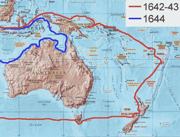
Tasman's expeditions.
Overall the Company was disappointed in Tasman's explorations. He had not found anything very profitable, and had only taken a superficial look at all the lands he discovered. The Company did not send Tasman exploring anymore, deciding that a more "persistent explorer" should be chosen next time; I guess they did not find one, because they did not send out any explorers at all. Still, Tasman was one of history's most important explorers, because he showed that Australia was not big enough to be Terra Australis Incognita, and that the southern hemisphere, like the northern, contains more water than land. Finally, Tasman completed a basic outline of the world�s landmasses. There were still some big blank spots on world maps, but with the exception of Antarctica and islands like Hawaii, they all turned out to be open sea.
For more than a century after Tasman, the only visitors to Australia/New Holland were more ships full of crews that had lost their way. The most interesting character to drop in was a buccaneer named William Dampier (1651-1715). What made Dampier fascinating was that he thirsted for both knowledge and wealth, so he was an explorer and a scientist as well as a pirate. In the course of his raids, he became the first person to circumnavigate the globe three times. Because Dampier wore many hats, a typical raid would see his crew loot and burn a village, kill the natives--and make observations of the local flora and fauna at the same time.
In 1688, on the first voyage, Dampier's ship ran aground on the northwest coast of Australia, so he was the first Englishman on that continent.(6) After that, the ship went to the Nicobar Islands, in the Indian Ocean. There Dampier had an argument with the other crew members, and he settled it by loading his belongings in a native canoe and shoving off to the nearest desert isle, presumably after giving the crew a few choice insults. But instead of staying on that isle, he set a course across the Bay of Bengal, survived a fierce storm on the way, and made it to the Indonesian kingdom of Acheh. Incredibly, he showed up in England three years later (1691), along with his journals and a tattooed prince for his slave.
All his adventures gave Dampier enough material to write a very entertaining travel book, A New Voyage Around the World. Besides the incidents mentioned above, he told about eating flamingo tongues in the Cape Verde Islands, and how, like Drake, his pirates raided Spanish colonies around the Pacific. On his second expedition, a Scotsman in his crew, Alexander Selkirk, decided that his ship was unseaworthy, and marooned himself on an uninhabited island off the coast of Chile. Selkirk was still alive four years later, when Dampier returned to the island and rescued him; this would inspire Daniel Defoe to write Robinson Crusoe, the most famous story about a castaway. Then in 1726, Jonathan Swift, another writer who thought the Pacific was a fascinating place, gave his imagination free rein by writing Gulliver's Travels. Because so much of this region was still uncharted, Swift put Lilliput, his land of midgets, where Australia should have been (he said it was northwest of Tasmania), while Brobdingnag, his land of giants, was somewhere in the north Pacific.
![]()
Pohnpei Liberated
While the Dutch were charting the coast of "New Holland," the glory days ended for Nan Madol, the remarkable city built by Micronesians on the coast of one of their islands, Pohnpei. We briefly looked at Nan Madol in the previous chapter, when a series of new rulers, the Saudeleur dynasty, took over Pohnpei and ordered Nan Madol's construction.
The Saudeleurs brought five hundred years of peace - no wars were fought with communities on other islands - and the first Saudeleur rulers were kind to their subjects. However, cruel rulers followed, and all of them demanded much from the people, in both tribute and labor. Eventually a Saudeleur offended Nan Sapwe, the god of thunder, and the priesthood predicted the dynasty's downfall. Then in 1628, a stranger named Isokelekel came from the island of Kosrae, leading a party of 333 men, women and children. Isokelekel is described as darker-skinned than the people of Pohnpei, and he supposedly lived his early years somewhere to the south, suggesting that he and his followers were Melanesian or even Papuan. The last Saudeleur, Saudemwohl, entertained the visitors at Nan Madol, but sometime after that, a fight broke out between the visitors and the natives; different versions of the legend disagree on who started it.
Oppressed Micronesians went over to the visitors, allowing them to prevail. In the end Saudemwohl escaped by retreating up a hill to a stream and changing himself into a fish. However, it wasn't a bloodless victory. At one point in the Saudeleur retreat, Saudemwohl's chief lieutenant threw a stone at Isokelekel, taking an eye out. After the battle, Isokelekel showed his admiration for the lieutenant's skill and courage by naming him a general; today the people on Pohnpei with the highest status are the descendants of Isokelekel and the descendants of that general.
Isokelekel moved into Nan Madol and gave himself a new title, calling himself the first nahnmwarki. The government he established was decentralized, compared with the preceding one; Pohnpei was divided into three (later five) autonomous districts, ruled by lesser chiefs called nahnken. He and his party intermarried with Pohnpeian families, giving the island's residents the mixed racial ancestry they have today. Because they came as liberators, Isokelekel decided he would not force the people to deliver the food and drink needed by the city; the new rulers would have to bring it in themselves. But since this job was a great burden for their subjects, one can imagine how much more of a burden it was for the nobility. Eventually folks in the city moved away to places where food was easier to get, the elite decided that feeding the city was too much work, and Nan Madol was abandoned.
The Micronesian myths about Isokelekel conclude with what may be the strangest death reported on this website. Supposedly, one day Isokelekel saw his reflection in a pool of water and, realizing he was getting old, decided he should commit suicide. To do this he bent down a young palm tree, tied his penis to the top, and when the tree was released, it tore the member off, causing him to bleed to death from this self-mutilation. Not Darwin Awards material, since Isokelekel meant to do that, but it makes one wonder, "Where's Lorena Bobbitt when you need her?"
Twenty-two generations have gone by on Pohnpei since Isokelekel arrived. The loose system he established worked for two and a half centuries, until Spain got involved in Micronesia. Today the island's chiefs all claim descent from Isokelekel, and still go by the titles of nahnmwarki and nahnken.
![]()
The Discovery of Easter Island
The early eighteenth century was an intermission in the age of exploration; there wasn't as much exploring during this time as there was before and after it. Each of the countries inclined to send out explorers lost interest, for various reasons. Portugal was no longer in the exploring business, the Spanish Empire was more than a hundred years past its peak, and the Dutch now had everything they had wanted when they got started. Nor could you expect to see Asian explorers, because the four most important countries in the Far East (China, Japan, Korea and Siam) had all withdrawn into themselves, shutting their doors against the outside world; we won't hear from them again until pushy foreigners force their way in. Russia was active, but the fact that all their expeditions began with an overland hike across two continents (from St. Petersburg to the Sea of Okhotsk) meant they would limit their activity to the north Pacific. The main thing the Russians got from their exploration was Alaska; read my Russian history for details on that. That left France and Great Britain, and currently they were exploring places closer to home, like North America. In the Pacific, these two nations weren't even in the game yet.
The one expedition we will cover in this section was led by the Dutchman Jacob Roggeveen; from 1721 to 1723 he made another attempt to find Terra Australis Incognita. This expedition was not sent by the Dutch East India Company but by its rival in the Atlantic, the Dutch West India Company (WIC). The WIC had no business sending ships into the Pacific, but it had gotten the idea that if the expedition entered and left by way of Cape Horn, technically it would not be violating the East India Company's trade monopoly. This legal matter also seems to be the reason why Roggeveen was chosen to command, for he was a sixty-two-year-old lawyer, not an experienced ship captain.
Roggeveen set sail with three ships, rounded the Cape, and discovered Easter Island (named because it was sighted on Easter Sunday of 1722). From there he sailed west-northwest, spotting a few of the Tuamotu and Society Islands (Bora Bora is the best known island that he saw); he also discovered Samoa, but just made a close pass instead of stopping there. At this point, being more than halfway across the Pacific, he should have turned around. Instead, he continued to Indonesia, and to Batavia, headquarters of the Dutch East India Company. There Roggeveen claimed he had to cross the Pacific, because he could not catch winds blowing the right way; the Company authorities didn't believe the story, arrested him and confiscated the ships. However, the Company was later ordered to release him, pay him and his crew for their trouble, and let them return to the Netherlands.
Roggeveen was impressed by the moai, but unlike so many of today's writers, he didn't find the statues mysterious. He thought the natives shaped the statues out of mud on the spots where the completed statues stood. In truth they are carved out of volcanic rock, and he should have known this; today you can still go to Rano Raraku, an extinct volcano on one corner of the island, and see the quarry containing statues that were never completed. After spending time on Easter Island in the 1950s, Thor Heyerdahl presented a better explanation of how the natives carved the statues, hauled them to their present locations, and raised them, in his book Aku-Aku.
The island was nearly barren and had about 2,000 inhabitants at the time of Roggeveen's visit; as noted earlier in this work, we know that there used to be more people and trees, before the self-inflicted environmental disaster. The natives greeted Roggeveen by paddling out to his ships in canoes so leaky that they had to spend half their time bailing to keep from sinking. Unlike other Polynesians, these were not great boat-builders, because they did not have enough wood to do the job right; Roggeveen only saw three or four canoes on the whole island. Obviously the natives couldn't make the long journeys needed to visit other lands in such boats, so understandably they had gotten the idea that they were the only humans living anywhere, and their island was the "navel of the world."
In the century after Roggeveen, there was some kind of religious or political revolution, because the natives proceeded to pull down their statues. When James Cook came by in 1774, he reported that some statues had fallen over; by 1868 there were no statues left standing. At the same time, the natives had also forgotten why the statues had been made in the first place, completing the mystery. In response to this, a theory arose that there had once been two groups of people living on the island, the Hanau epe or "Long-ears," and the Hanau momoko or "Short-ears." The Long-ears got their name because they supposedly had unusually long earlobes, like most of the statues; the theory goes on to suggest that the Long-ears colonized the island first, and made the statues. Where the Long-ears came from was never stated, though some (including Heyerdahl) have proposed South America. Later came the Short-ears, the supposed ancestors of today's islanders (whom everyone admits are Polynesian in ancestry). Sometime after their arrival, fighting broke out between the two groups. The Short-ears exterminated every Long-ear and pulled down the statues; the idea that they were not the builders explains their ignorance about the purpose of the statues.
That is how the story goes, and it appeals to fans of lost civilizations. But the real story is probably less exciting; the long ears on the statues were probably just an artistic convention, like the halos Western artists put around the heads of saints. And if there ever was a war on the island, it wasn't a race war but a war between Polynesian groups; the Long-ears could have been a priestly or ruling class. As for the toppling of the statues, it may have happened simply because the natives could no longer afford to sustain the cult which motivated their construction.
![]()
The Discovery of Tahiti
By this time of Roggeveen's expedition, the Dutch were falling behind the British and the French in the game of imperial competition, so those two European powers would provide the next generation of explorers. But while there were military activities in the Pacific that involved the British Navy, during the War of the Austrian Succession and the Seven Years War, neither country was ready to go exploring until after the Seven Years War ended, in 1763. At this point the French were motivated to explore because they wanted a new colony to replace what they had lost in North America and India; conquering Terra Australis Incognita would be a very nice compensation indeed. The British just wanted to maintain the balance of power; they had to keep the French from getting a new empire, and to make sure Britannia continued to rule the high seas.
For the first expedition (1764) London put two ships, the Dolphin and the Tamar, under the command of John Byron, a hero from the recently concluded war, and ordered him to complete the exploration of North America's Pacific coast. Previous North American explorers had failed to find a "northwest passage" through the continent, and it was hoped that if the passage existed, this expedition would find the western end of it. On the way to the Pacific, Byron stopped at the Falkland Islands and claimed them for Britain, beginning Britain's long involvement in the south Atlantic that continues to this day. He was nicknamed "Foul Weather Jack" because he had a talent for getting caught in storms while sailing, but the storms he encountered around Cape Horn left his ships in such bad shape that he decided to go straight home without carrying out the mission, and because he didn't want to take any chances with Cape Horn again, that meant going due west across the Pacific and Indian Oceans. On the way he discovered some minor islands in the Tuamotu, Tokelau and Gilbert archipelagoes, and the whole journey took twenty-two months, the fastest circumnavigation of the globe anyone had achieved so far. While you may not think kindly of Byron because he did not obey orders, what he achieved was enough to make the Admiralty call the expedition a success; for his next assignment they made him governor of a province in Canada, Newfoundland, for three years.
The Dolphin was refurbished and sent with another ship, the Swallow, on the next Pacific expedition, in 1766. This time Samuel Wallis commanded the Dolphin while Philip Carteret commanded the Swallow. Their mission was to find out once and for all if a great southern continent existed, collect information on it, and claim the land for the United Kingdom if it turned out to be uninhabited. They took the Spanish route, through the south Atlantic and the Straits of Magellan, whereupon they were separated by a storm. After that they never saw each other, but Wallis and Carteret followed roughly parallel courses to the northwest. Trying to keep as far south as possible, Carteret discovered Pitcairn Island, and then passed south of the Tuamotu archipelago; he knew that he was following the same course as Quiros, but while he sailed in an area that was marked on his chart as "land seen by Quiros," there was no sign of land. Then he re-discovered Santa Cruz and the Solomon Islands, but failed to identify either with Mendana�s landfalls. By now his crew was ill from scurvy, and his ship was so rotten it never should have been allowed to sail, so instead of looking for Espiritu Santo they headed to the Philippines for some fresh food and rest. On this leg of the journey, Carteret made his most important discovery--that New Ireland and New Britain were separate islands (he sailed between them).
Meanwhile Wallis sailed through the Tuamotu Archipelago and began a different sort of legend, for he discovered Tahiti. Here food was so abundant and the climate was so moderate that people could stay outdoors all year round. At first the crew rejoiced; having taken one look at the beauty of the place, they jumped to the conclusion that this was the continent they had been looking for. However, the initial native reaction was hostile; Tahitian warriors came out in hundreds of canoes and threw stones at the intruding ship; in the resulting skirmish, one Tahitian was killed and another was wounded. Fortunately they soon realized that the newcomers were not invaders, and the two sides quickly made peace.
By this time, the crew knew that they had not discovered a continent, but it had plenty of attractions to make them want to stay, especially the now-famous Tahitian girls. The sight of the women, according to George Robertson, the first mate, "made all our men madly fond of the shore, even the sick which had been on the doctor's list for some weeks before.' Since iron could not be found on the islands, the crew and the native women quickly made a deal--an evening of pleasure for one good-sized nail. A few days later, Robertson wrote, "when I was ordering the liberty men into the boat the carpenter came and told me every cleat in the ship was drawn, and all the nails carried off . . . the boatswain informed me that most of the hammock nails was drawn, and two thirds of the men obliged to lay on the deck for want of nails to hang their hammocks." When the time came to leave, even Wallis had to say a tearful goodbye to a lovely native girl, Princess Purea.
Wallis went on to discover some of the other Society Islands and Rongerik in the Marshalls, but now he is remembered for Tahiti. When he got back to England in 1768, the Admiralty praised him because he sailed for twenty-one months without losing a single man, but they weren't very impressed that he had found the classic island paradise, instead of the fabled southern continent.
Meanwhile, France sent its own explorer to the Pacific: Louis Antoine de Bouganville. Bouganville commanded two ships and 300 men; because this was the Age of Reason, he also brought more scientists than previous expeditions had done. The latter included Philibert Commerson, a naturalist who brought back 5,000 plant and animal specimens, and Pierre Antoine V�ron, an astronomer who used lunar observations and mathematics to pinpoint the locations of islands with great accuracy. On April 6, 1768, they arrived at Tahiti, and the natives came to greet them in canoes full of fruit. Even before dropping anchor, Bouganville was confronted by the same charming problem. "In spite of all our precautions, one young woman came aboard onto the poop and stood by one of the hatches above the capstan . . . the young girl negligently allowed her loincloth to fall to the ground, and appeared to all eyes such as Venus showed herself to the Phrygian shepherd. She had the goddess� celestial form . . . I ask; how could one keep at work, in the midst of such a spectacle, four hundred Frenchmen, young sailors who for six months had not seen a woman?" As you might expect if you know anything about the French, they were even more enthusiastic about the Tahitian women than the British sailors had been. The women liked the French, too; this time they did not demand nails for sexual favors. Commerson thought Tahiti proved the theories of the philosopher Jean Jacques Rousseau; here was a community of "noble savages," primitive people who were innocent, happy and free of prejudice. The natives did steal quite a few things that belonged to the newcomers, but Commerson and Bouganville did not let this cause them to think unkindly of their hosts. Bouganville noted that the natives did not steal from other natives, and remarked that "curiosity for new objects excites cupidity in them." They might have felt differently if the expedition had stayed at Tahiti for more than thirteen days, e.g, they did not learn that the Polynesian religion sometimes calls for infanticide and human sacrifice.(7)
After leaving Tahiti, Bouganville headed west to try his luck at finding Terra Australis. He came first to Samoa, then to Vanuatu, and explored the waters between them and Australia, but fared little better than his predecessors. By this time provisions were so low that Bouganville wrote in his journal that, "at supper we ate some rats, and found them very good." The crew also suffered from scurvy and venereal disease; the latter ailment was picked up from the Tahitians, who had in turn gotten it from Wallis' expedition. Then came a brief diversion from the rats and suffering. One of the sailors, Jean Baret, a devoted manservant of Commerson, had caused some puzzlement by showing no interest in the girls of Tahiti. Now it was discovered that "he" was really a girl named Jeanne, and Commerson's mistress to boot! She was an orphan who had disguised her identity and joined the crew to experience adventure. Because her relationship with Commerson went against regulations, the two had to stay in separate cabins for the rest of the trip. Coming out of the closet must have made life more complicated for Jeanne Baret, but it also meant she would be the first woman on record to go all the way around the world.
Keeping to his determined course, Bouganville eventually reached the Great Barrier Reef of Australia.(8) Finding no easy way through the reefs, and knowing that this sea was nothing like the ones described by other visitors to this part of the world, he gave up and left the Pacific via northern New Guinea and Indonesia. Near Ascension Island in the Atlantic, he caught up with and passed Carteret�s lumbering vessel. "How he must have suffered in such a poor ship!" he wrote in his journal. Yet it was the greatest explorer of the eighteenth century, James Cook, who would finally lay the Terra Australis myth to rest with two equally slow ships, the Endeavour and the Resolution.
But before we get to Captain Cook's adventures, one more story about Tahiti should be told. Because Tahiti was the nicest island found in the Pacific so far, both Britain and France had understandably claimed it after their explorers brought back their reports about the place. So did Spain, for the Spaniards still felt that anything in the Pacific belonged to them until they said otherwise. In 1772, after Cook's first visit to Tahiti (see below), the viceroy of Peru decided he needed to occupy Tahiti for Spain, before the British built a base there. To show the Tahitians who was in charge now, he dispatched one ship, the Aguilla, commanded by Domingo Bernardo de Bonechea Andonaegui. The ship reached Tahiti after two months at sea, dropped anchor beside the village of Tautira, and de Bonechea rechristened the village "Sant�sima Cruz." The Tahitians found this group of Europeans odd, because de Bonechea ordered his men not to have sex with the native women. After five weeks on the island, the Spaniards left behind two missionaries and went home.
De Bonechea went to Tahiti again in 1774 to follow up on the missionaries, this time bringing two ships, the Aguilla and the Jupiter. The missionaries were spectacularly incompetent; they were too afraid of the natives to convert any of them, and were more than happy to catch a ride back to Peru. De Bonechea managed to get the support of a local chief (the future Pomare I) to build a mission on the island, but not long after that he fell ill and died, in January 1775. The mission was abandoned later in the same year, and Spanish activity on Tahiti ended.
![]()
Captain Cook
Bouganville's voyage around the globe put France in the lead when it came to exploring the Pacific, but only briefly. Now Britain would send forth the greatest Pacific explorer of all, James Cook (1728-79), to discover more than all his predecessors put together. Preparations for Cook's first expedition were made even before Wallis and Bouganville returned from Tahiti. This time the motivation, like that for Bouganville's expedition, was pure science, and we need to digress from the narrative to explain what the scientists wanted.
Back in 1691, the English astronomer Edmund Halley (the same Halley who discovered Halley's Comet) proposed an experiment, involving observations of the planet Venus as it passed across the face of the sun. If a so-called transit of Venus could be watched from more than one location, and the exact length of time for the transit in each location was measured, it would be possible, through geometry, to measure the exact distance of the earth from the sun. Unfortunately, transits of Venus don't happen very often; typically they occur in pairs spaced eight years apart, with more than a century between each pair. This meant Halley did not get a chance to observe a transit in his lifetime, and the next ones would take place in 1761, 1769, 1874, 1882, 2004, and 2012. For the 1769 transit, Britain's Royal Society already had plans to observe it from Hudson Bay in Canada, and from northern Norway. Because it helped to have the observation points as far apart as possible, the Royal Society also wanted someone to watch the transit from the Antipodes. The Navy agreed to provide a ship for the scientists, as long as they could also use it to explore some lands in the South Pacific and claim them for Britain.
The ship used was a sturdy collier, that had previously been used to transport coal from Newcastle to London. Originally named the Earl of Pembroke, she was refitted for ocean voyages and re-christened the HMS Endeavour. The choice to command the expedition was a bit of a surprise; Lieutenant James Cook had come from a very ordinary background. The son of a lowly Yorkshire laborer, Cook worked as a farm hand and a grocer's assistant before joining the Navy at the age of twenty-seven. He was picked for the job of captain because when he served in Canada during the recent French and Indian War, he proved himself an expert navigator and map maker, producing excellent charts of the lower St. Lawrence valley and the entire coast of Newfoundland. In May 1768, three months before the Endeavour was ready to go, Wallis arrived with his report on Tahiti, and everyone agreed that Tahiti would be an ideal place to observe the transit. Cook's instructions were drawn up accordingly: first he would go to Tahiti, then when the transit was finished, he would head south about 1,250 miles to look for the great southern continent. If he failed to find or explore Terra Australis Incognita, he would go west next, and explore the coast of Tasman's New Zealand. Wherever he went, he had orders to make friends with any people he met, and take possession of all newly discovered lands for the king of England.
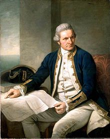
James Cook.
To carry out these instructions faithfully, Cook would need to accurately know the longitude and latitude of each place where he was going, and the science of navigation had improved tremendously in the eighteenth century. We saw how earlier navigators could only guess how far east or west they were. At best, this was causing crews to waste time, figuring out where they were; at worst, errors in navigation led to the loss of ships and lives. To cut all these losses, in 1714 the Admiralty stimulated research in developing better navigation techniques, by offering a prize of �20,000 (at least $8 million in today's dollars) to anyone who could calculate a ship's longitude to within a half a degree, or 35 miles, at the equator.
By the 1760s, two methods had been developed that were showing great results. The first method, using the measurement of "lunar distances,"� had the navigator watch the moon rise, set or cross the local meridian, and use the timings of those events to calculate where on earth he was. This is straightforward enough if you can see the moon and do the math involved; the drawbacks were that observations could be difficult at sea, and most sailors weren't mathematicians. The other method was easier for sailors, and involved comparing the time of day at the Royal Observatory in Greenwich, England, with the time of day wherever the ship happened to be. If the difference in times was correctly determined, one could measure the ship's distance around the world in degrees from Greenwich, and because there are 1,440 minutes in a 24-hour day, each minute's difference worked out to one fourth of a degree, or 17.5 miles at the equator. What a navigator needed for this was a marine chronometer, a mechanical clock set to the exact time in Greenwich. Early clocks had tended to change speed when the temperature changed, and on the rolling seas, any clock that used a pendulum was right out! Now a Yorkshire clockmaker, John Harrison, built a chronometer accurate enough to meet the terms of the contest. Unfortunately for him the Board of Longitude did not honor the agreement; it only paid Harrison half of the prize money, stating that he had not proven a copy of his clock would work as well as the original. Consequently Cook did not have a chronometer with him on his first voyage, just a bunch of tables for predicting the moon's movements. This didn't bother him, though, because he had gotten good at observing "lunar distances,"� and was justly proud of that skill.
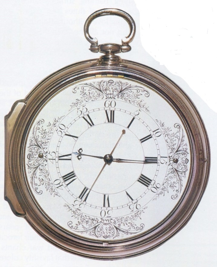
John Harrison's chronometer.
The First Voyage
The Endeavour rounded Cape Horn and made it to Tahiti on schedule; all they had to do was set up their equipment for observing the transit and hope the weather would cooperate.(9) It did, but the atmosphere of Venus made the planet appear fuzzy in front of the sun's disk, so measurements of how long it took to cross the sun weren't exact. Nevertheless, the experiment was worth all the trouble; the final calculation of the sun's distance was within one percent of the true value, much better than previous calculations.
With the Tahitian experiment completed, Cook took a quick look at the islands surrounding Tahiti, and named them the Society Islands because he thought they all made a good association. Then he headed south, got as far as latitude 40� S. without spotting a great southern continent, decided it did not exist, and headed for New Zealand. Cook did a better job of exploring New Zealand than Tasman had, discovering the strait between North and South Island and sailing all the way around both. A Tahitian named Tupaia, who had joined the Endeavour's crew, acted successfully as an interpreter when they encountered the Maori, but these warriors were as short-tempered as ever; twice his marines had to fire their muskets, and four Maori were killed in skirmishes. Still, during the six months that Cook spent charting the New Zealand coast, he succeeded in establishing good relations with some Maori groups. Afterwards, in his description of Zealand, he talked about its "strong, raw-boned, well made" inhabitants, and here made one of the few mistakes of his career; he suggested that the land would be easy for Europeans to settle because the natives were divided into too many groups to fight back effectively.
The Endeavour was the first European ship to visit New Zealand in 127 years, but it wasn't alone. While in India, a French trader, Jean-Fran�ois-Marie de Surville, heard rumors about the British discovering a very rich island in the South Pacific. Actually it was a garbled report about Wallis discovering Tahiti; nevertheless, de Surville got financial backing from the French East India Company to go check it out. From India he guided his ship, the St. Jean Baptiste, to Malacca, took on supplies, sailed across the South China Sea as far as the Philippines, and then continued south without making any landfalls until the ship reached the Solomon Islands. At this point the crew was suffering badly from scurvy, but when they tried stopping to acquire water and fresh food, they were attacked by unfriendly islanders. Although de Surville performed a valuable service by mapping the parts of the Solomons that Europeans hadn't seen yet, saving his crew was now more important, and when he looked on his maps, the nearest place which might have the supplies they needed was Abel Tasman's New Zealand, so he set a course in that direction. The St. Jean Baptiste reached New Zealand on December 12, 1769, coincidentally on the same coast that the Endeavour happened to be exploring; a storm kept Cook and Surville from spotting each other, though. Soon more bad weather damaged the ship, forcing it to stay until repairs could be made. Thus, the French crew spent Christmas on the coast, at which time the ship chaplain, Father Paul-Antoine L�onard de Villefeix, conducted the first Christian services in New Zealand.
De Surville was careful to maintain good relations with the Maori during his stay, and did some trading with them. However, near the end of the stay the Maori took a shift's boat that had drifted ashore, and the French retaliated by burning some huts along the beach, and by kidnapping Ranginui, the local chief. What happened after the ship left New Zealand is unclear, except that de Surville did not make it back to Europe. Ranginui was well treated, eating his meals at the captain's table, but, like many others, he came down with scurvy and died at sea, because the ship encountered no land between New Zealand and South America. Therefore the crew became sick with scurvy again. When they reached the coast of Peru, de Surville tried to go ashore and get help for his crew, only to drown in heavy seas (April 8, 1770). Well, that's what the official histories tell us. An Australian author, Alan John Villiers, wrote an alternate story about de Surville's fate, asserting that in May 1772, de Surville was captured by the Maori at the Bay of Islands and eaten (Captain Cook - The Seaman's Seaman, Penguin Books, 1967, page 154). Villiers probably got de Surville confused with Marc-Joseph Marion Dufresne, a French explorer we'll see in the next section.
Now let's go back to what Cook was doing. Because Cook had completed the instructions given to him, he could have just gone home from New Zealand, but instead he did some more exploring on the way back. With "New Holland" as the nearest landmass, he set a course for the part of it the Dutch never saw, the unknown east coast. They made landfall just south of present-day Sydney, on April 28, 1770, three weeks after leaving New Zealand. The scientist Joseph Banks loved this spot; he discovered more than 200 new species of plants here, and called it Botany Bay. From there they followed the coast northward for 1,900 miles, and suffered a disaster that nearly ruined the expedition. While squeezing through a narrow gap between the Great Barrier Reef and the Queensland coast, the Endeavour ran aground, forcing a layover of seven weeks while the crew freed and repaired the ship. During the stay, Banks caught a kangaroo and added it to his specimens, and the crew made contact with the Aborigines, noting that they were not at all like the Polynesians.
In August they were ready to set sail again. On a small island off Cape York, Cook raised the Union Jack, establishing Great Britain as the ruler over all of eastern Australia. Cook thought the east coast looked a lot like Wales, so he named it New Wales. Folks back in Britain liked this name better than New Holland, of course, but because it was in the southern hemisphere, they added "south" to make it New South Wales. After sailing around Cape York (and confirming the existence of Torres Strait), the Endeavour went to Java, stopped for rest and resupply at Batavia, and returned to Europe by way of the Indian Ocean and the Cape of Good Hope.(10) They arrived in London in July 1771, so the total length of the voyage had been thirty-five months.
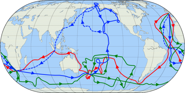
The course of Cook's voyages: the first (red), second (green), and third (blue). The dotted blue line indicates how they got back to England after Cook's death. From Wikimedia Commons.
The Second Voyage
Cook had done such a good job as a leader, diplomat and explorer that the Admiralty decided to send him out again almost immediately. This time he would command two ships, both former colliers like the Endeavour: the Resolution and the Adventure. After Cook's experience on the Great Barrier reef, everyone agreed that two ships were safer than one. Some folks still believed that there was a continent besides Australia in the South Pacific, so Cook's assignment was to sail into the uncharted waters south and east of New Zealand, go as far south as it was possible to go, and find out, once and for all, if there was any truth to the idea of Terra Australis Incognita. Though this wasn't considered a scientific expedition, he would still bring scientists: two naturalists, two astronomers, and an artist. This time he would also bring a chronometer. The Board of Longitude was finally convinced that John Harrison's clock worked as well as he said it did, so in 1773, while Cook was on his second expedition, they belatedly paid Harrison the �10,000 in prize money that was still owed to him. The era of exact navigation had arrived at last.
We saw that there was a French expedition in the vicinity of New Zealand at the same time as Cook's first expedition, and it was far less successful. Likewise, there was another French expedition in the South Pacific when Cook went there again. Marc-Joseph Marion du Fresne was a ship captain with the French East India Company, and when the Company dissolved after the Seven Years War, he was left unemployed. So when the French government decided to return Aotourou to Tahiti (see footnote #7), du Fresne volunteered for the job; he was given two ships, and told to explore the southern oceans while going there and back. The second assignment meant that du Fresne kept going after Aotourou's death; steering a course into subantarctic waters, he discovered the Prince Edward Islands and the Crozet Islands, before sailing east to Van Dieman's Land. Arriving in March of 1772, he sent a landing party ashore, and they became the first Europeans to make contact with the Tasmanians. Because the Tasmanians were naked, Du Fresne ordered everyone in the landing party to strip off all their clothes, so the natives would see they were ordinary people, too. This sounded like a good idea, but instead the French were attacked with spears and stones; a naked sailor fired shots back, killing one native and wounding others. A few days later du Fresne decided they weren't going to get much done on this island, and the expedition continued on to New Zealand.
At New Zealand they sailed around North Island for several days, looking for a place with fresh water and timber, which were badly needed, until they decided the Bay of Islands was the best place to land. From Aotourou they had learned quite a few words of the Tahitian language, and this allowed them to communicate with the Maori. The Maori were friendly enough, so the ships stayed there for the next three months. During this time damage to the ships was repaired, and a tent was set up on dry land for recovering scurvy victims. More than once du Fresne traveled inland, to explore, hunt, fish and trade with his Maori friends. Suddenly, du Fresne and twenty-six of his crew were ambushed by the Maori, killed and eaten. We don't know why the Maori turned against the French without warning; some history books have asserted that du Fresne broke a local taboo, by fishing in an area the Maori thought had been cursed by the gods. Du Fresne's chief lieutenant, Jules Crozet, took command of the expedition, and he retaliated by burning a village and massacring 250 Maori. Then to add insult to injury, just before the French left New Zealand, they buried a bottle containing a note which stated that New Zealand was now French territory, and would henceforth be called France Australe. Returning to France by way of Guam and the Philippines, Crozet wrote the official account of the expedition, and told Jean-Jacques Rousseau that the natives of Van Dieman's Land and New Zealand were "children of nature" like he had written about, but in no way were they "noble savages"; for the philosopher this was an awful shock.
Now let's go back to the Cook narrative. Cook's second expedition lasted three years (1772-75). In October 1773 they made a stop at Tonga, where Cook was impressed by the huge, unarmed crowd that came to greet the ships. Aside from that, though, most of the expedition was spent in the empty southernmost waters of the Atlantic, Indian and Pacific Oceans, putting an end to dreams of a habitable great southern continent. While Cook's ships were the first on record to sail below the Antarctic Circle, the course they took also meant that the second expedition did not have as many highlights as the first. One of those highlights came on January 30, 1774, when the Resolution, now at latitude 71� 10" S., came to a vast ice field that blocked their progress southward. As the ship turned around, a sixteen-year-old midshipman, George Vancouver (a future explorer in his own right), climbed to the end of the bowsprit, waved his cap, and shouted in French, "Ne plus ultra!" ("None farther!"�). Because of this stunt, Vancouver could claim afterward that he had been farther south than anyone else who had ever lived. During the winter months, when it was unsafe to explore the Antarctic, Cook returned to the south temperate zone and used his navigational skills to pinpoint the correct locations of some previously discovered Pacific islands. At the same time, he discovered thirty new islands, the most important being New Caledonia, and South Georgia in the Atlantic. Because of the enthusiastic greeting he had received at Tonga, he dropped in there again, got another warm welcome, and renamed those islands the Friendly Archipelago. Finally, he spent six weeks among the islands of Vanuatu (which he renamed the New Hebrides), paid three visits to New Zealand and two visits to Tahiti; from the latter he brought back a young Tahitian named Omai.
Over the course of the expedition, Cook had sailed almost 70,000 miles without losing a single man to scurvy. For this and his other achievements, Cook finally got official recognition when he returned to England. He was promoted to the rank of captain, elected into the Royal Society, and was personally congratulated by King George III. Another big hit was Omai, who acted so dignified that everyone who met him thought he was a perfect example of a "noble savage." When he was taken to meet the king, Omai greeted him by saying, "How do, King Tosh?" Nobody knew what Omai meant by this, but King George gave him an allowance and prudently suggested that he be vaccinated for smallpox, so he would not suffer the fate of Aotourou.
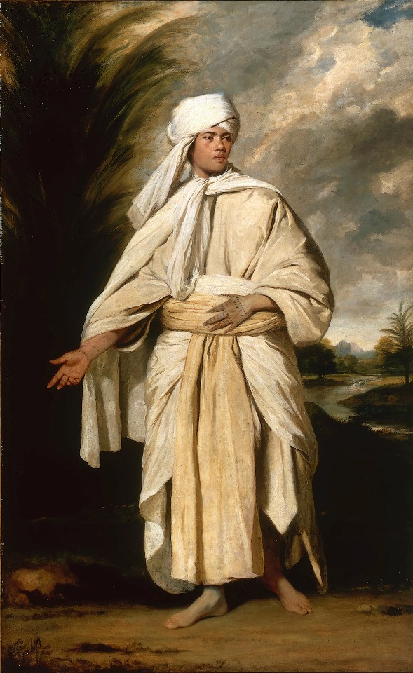
Omai.
Though he was famous and financially secure, Cook wanted to get back to sea. Now that the layout of the southern seas had been settled, for his third expedition Cook would try to solve another geographical mystery. For more than two hundred years, sailors had been seeking an easy water route between the Atlantic and the Pacific, either a "northeast passage"� through the Arctic above Europe and Asia, or a"northwest passage"� through North America. So far searches for the northwest passage had been conducted around Hudson Bay or along North America's Atlantic coast, and all had failed, so Cook was going to look for the passage from the Pacific side. The Pacific coast of Canada had not yet been explored, and the European power with an interest in the north Pacific, Russia, was not finished exploring Alaska, meaning it was quite possible for a waterway to exist somewhere in the region. If Cook found the passage, he would use it to try to return to the north Atlantic. Failing that, he would head for the waterway Europe knew about, the Bering Strait, and sail along Canada's Arctic coast; if he could not do that either, Plan C called for trying the northeast passage around Siberia. The Admiralty refitted the Resolution so Cook could use it again, and for his other ship, they gave him one more souped-up collier, the Discovery.
![]()
The Third Voyage
Cook's third expedition departed on July 12, 1776; this voyage would be the longest of them all, lasting four years. The official reason for the voyage was to take Omai home, but of course Cook would do much more while he was on the other side of the world from Europe. First he headed for Tonga, since the "Friendly Archipelago" had proven to be a great place for rest stops.(11) This time the expedition stayed nearly three months, because a local chief, Finau, would not stop entertaining his guests. What Cook did not realize was that Finau was planning to kill the entire crew of the expedition, and loot the ships of their fancy Western-made goods. Fortunately for Cook, infighting between Finau and the other chiefs kept them from agreeing on when and where they would commit this murder, and the Resolution and the Discovery left to continue their voyage before the plot was carried out. We know about the plot because it was discovered by William Mariner, a writer who spent several years on Tonga in the early 1800s, and wrote a book about his experiences in 1817.
After Tonga, Cook dropped off Omai at Tahiti, and then the real exploration began. From Tahiti he sailed due north, and discovered Christmas Island on December 24, 1777. Far more important were the three large volcanic islands that came into view on January 18, 1778; none of them were on his charts. These were the Hawaiian islands of Oahu, Kauai and Niihau; Cook had discovered Hawaii, the last pieces of land visited by Europeans that had people living on them.
Cook made his first Hawaiian landfall at Waimea Harbor on Kauai. The natives were both excited and terrified by his arrival, not knowing what to make of these strange white-winged ships and the light-skinned men they carried.(12) They paid homage to Cook, thinking he was a god, though he did not realize it at the time. Cook was also amazed, that he could stumble on islands this big without warning; he wrote in his journal, "How shall we account for this Nation spreading itself so far over this Vast ocean?" He traded iron and trinkets with the natives for fresh food, did a little sightseeing, and then headed over to Niihau. Here the men traded for salt and yams; in return, they left goats, pigs, and the seeds for melons, pumpkins and onions, thus introducing the first non-Polynesian plants and animals to the islands.(13) Altogether Cook spent two weeks on Kauai and Niihau, and before leaving, he renamed Hawaii the Sandwich Islands. He wasn't thinking of food. He was thinking of his patron, John Montagu, the Fourth Earl of Sandwich (who incidentally, was the same Earl of Sandwich that came up with the idea of putting meat between two pieces of bread and calling it lunch).
Cook could not stay in Hawaii for long, because he needed to be on the coast of Canada or Alaska by spring to carry out his mission, and the Resolution badly needed repairs before that. He found a suitable spot for the repairs at Nootka Sound on Vancouver Island, and the ships stayed there for a month. Up to this time, Canada had mainly been known for animal furs, so when the men weren't doing the repair work, they traded with a friendly Indian tribe for furs. Once finished, they traveled along the coast, following the Pacific rim north and west. On June 15 the Resolution and Discovery reached the Aleutian Islands, and met the Aleuts, a tribe of Inuit, or Eskimos. Using the strait now called Cook Inlet, they entered the Bering Sea. At one point Cook saw both the Alaskan and Siberian shores, something thick fog had prevented the previous explorer in the neighborhood, Vitus Bering, from doing. By August they reached the edge of the pack ice on the Arctic side of the Bering Strait. They had crossed the Arctic Circle, but the ice meant they could not go home this way; there was no viable northwest passage.
It was too late in the season to make an attempt at the northeast passage, so Cook returned to Hawaii. Not only did it seem like a good idea to spend the winter there (these days, thousands of tourists do it every year), but mapping the "Sandwich Islands"� was one more service he could do for the Royal Navy. Accordingly, the Resolution and the Discovery sailed clockwise around all the islands before landing on Hawaii, the "Big Island." What a welcoming committee he got! Since the first visit, word of Cook's expedition had spread to the whole archipelago, so when he made his second coming, hundreds of swimming natives and more than a thousand canoes came out to follow his ships like a school of fish. What also worked in his favor was that the spot where he chose to land, Kealakekua Bay, was one of the most sacred places in the islands, and right at that time, a festival dedicated to Lono, the Hawaiian god of prosperity, was in progress at the bay. Another factor was that one of Lono's symbols was a white banner held on a crossbar, which looked a little like a mast with a sail. All this led the natives to believe that Cook really was Lono, and that he had come to bring them gifts. The chiefs on the Big Island treated him as an honored guest; they held boxing and wrestling matches in his honor, and the crew responded with tours of the ships, flute and violin contests, and most impressive of all--a fireworks show. But for some reason, the natives began to think this "Lono" might not be a god after all, maybe because he did not deliver the expected gifts. Cook sensed the feelings were changing because the chiefs kept asking him when he planned to leave.
Since they had worn out their welcome, the Resolution and the Discovery set sail on February 4, 1779, after staying for only two weeks. They should have waited until spring; not too far north of the Big Island they ran into a winter gale that broke the Resolution's foremast, forcing them to turn back for repairs. They showed up in Kealakekua Bay again, less than a week after leaving, and the reception was completely different. The Lono festival was over, the Hawaiians were now worshiping the war god Ku, and a chief, Kalaniopuu, put a kapu (Hawaiian for taboo) on the bay, so only a few permanent residents were there. It is one thing for a god or holy man to stage a second coming, but who said anything about a third one? The natives were also surprised that a god's property could be so badly damaged in his own domain.
Though the natives were polite enough, they did not bring tribute offerings like they had previously, and some got the idea it was all right to steal Western-made objects that caught their fancy, especially if they were made of metal. These thefts went from being a nuisance to an act that did real harm, when somebody stole a small boat, the Discovery's cutter. The enraged Cook went ashore with nine marines to get the boat back, the plan being to hold Chief Kalaniopuu hostage until the cutter was returned. Instead, a scuffle broke out, warriors attacked Cook's party with stones, clubs and daggers, and though Cook fired at one of his assailants with his musket, he missed and killed a bystander instead. The captain and four marines were killed before the other five marines managed to escape (February 14, 1779). Thus, Cook's death reminds us of Magellan's; both captains left a great legacy of exploration, and both came to a violent end in shallow water before completing their missions.
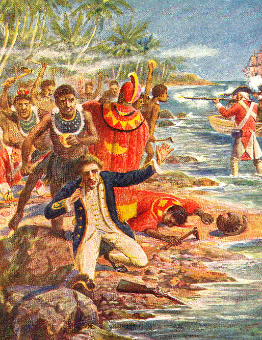
The death of Captain Cook.
Cook's crewmen were especially horrified at what the Hawaiians did to Cook/Lono's body. They cut it up and burned the pieces, and when two native delegations handed over bundles of bones, it wasn't all of the captain; some parts were apparently saved for religious ceremonies. The men did what they could to give a dignified burial at sea to the parts they had, and tried to retaliate by bombarding villages, setting fire to holy places, and killing natives, but since this didn't bring back the captain, they soon realized there wasn't much point in getting revenge. And the voyage was not over; they were still on the other side of the world and had to find their way home.
Charles Clerke, Cook's second in command, now led the expedition. They went to the Bering Strait to spend the summer trying to get through the ice a second time. However, Clerke was wasted from tuberculosis, and died soon after they left the strait for the last time; he was buried on the Kamchatka peninsula, and John Gore became the expedition's third commander. From Kamchatka they sent the ships' reports overland, meaning the reports got to London before the ships did. On the way back, they stopped at Macao, where the Chinese eagerly bought the sea otter pelts the crew had collected at Nootka Sound. The price paid by the Chinese was so high that it immediately established a new trade route across the north Pacific. From there they crossed the Indian Ocean by way of the Sunda Strait and Cape Town. In the Atlantic the American Revolution was still raging, but if the crews of the Resolution and Discovery were worried about hostile ships, they didn't have to be; because Cook's discoveries benefitted all of Western civilization, French and American ships had standing orders to leave the expedition alone, should they encounter it. Finally they arrived in England on October 4, 1780. Since people in London already knew that Cook and Clerke were dead, it was a subdued homecoming.
![]()
Epilogue
The age of European exploration began in the early fifteenth century, when Prince Henry the Navigator sent Portuguese ships to explore the coast of Africa, so it is fitting to end the age with another great navigator, namely James Cook, three and a half centuries later. Cook's three expeditions lasted a total of ten years, and after they were done, there were few territories left to be discovered. Another famous visitor to the Pacific, Charles Darwin, would later write that Cook "added a hemisphere to the civilized world."
However, Cook wasn't the last explorer of the Pacific, just the last major explorer. Two more expeditions came in the 1780s, and we should mention them in order to complete the exploration narrative. One, that of the French explorer Lap�rouse, will receive coverage in the first section of the next chapter, because it happened at the same time as the colonization of Australia, and ended disastrously. The other expedition was a Spanish one, and its commander was Francisco Antonio Mourelle de la R�a. Mourelle had been the pilot for Juan Francisco de la Bodega y Quadra, the explorer who charted North America's Pacific coast in the 1770s. But in 1780 he did not intend to discover anything; he was commanding a frigate, the La Princessa, on a routine voyage from the Philippines to Mexico. Instead, the winds blew him southward rather than eastward, until the ship reached the northern islands in the Tonga group (February 1781), which he promptly claimed for Spain. One week later he discovered Vav'au, the largest of the northern islands, renamed it Majorca, and spent some time getting entertained by the natives before moving on. We believe Mourelle made it as far as the Ha'apai group in central Tonga, because he spotted ten more islands and named them the Don Joseph de Galvez group. Then he turned around and made his way back to familiar waters, arriving at Guam in May 1781. After three weeks of R & R, he tried crossing the Pacific again; this time the winds cooperated, and he reached Mexico on September 27, 1781, thirteen months and three days after the voyage started.
Spain did not send a follow-up mission until 1793, when Captain Alessandro Malaspina came to Vav'au and reminded the inhabitants that they were now subjects of Spain. However, he did not stay there long, nor did he build or leave anything to establish Spanish sovereignty. No other Spanish ships came after that, because Spain would soon be busy with other affairs (i.e., the Napoleonic Wars, revolts in the Latin American colonies), and when the ships of other nations visited Tonga, it looks like they didn't even notice the Spanish claim.
When Louis Antoine de Bouganville left Tahiti, he wrote in his journal, "Farewell, happy and wise people. Remain always as you are now." It was not to be. Now that the islands of the Pacific had been contacted by Western civilization, they would never be the same again. The white people who are the main characters in the next chapter will not be explorers, but merchants, hunters going after whales and seals, missionaries, sailors, soldiers -- and in the case of Australia, New Zealand and Hawaii -- colonists.
This is the End of Chapter 2.
FOOTNOTES
1. If you really want to make the Polynesians look successful, throw in their Austronesian relatives who did not live on small Pacific islands. Around 1800, there were 1.5 million Malayo-Polynesians on Madagascar, and as many as 13 million in Southeast Asia.
2. "Unknown Southern Land" in English. This was often shortened to Terra Australis or Terra Incognita. When explorers started looking for the place, some folks called it Nondum Cognita instead, meaning "Not Yet Discovered."
3. Neither Saavedra nor Cortez can be called the discoverers of New Guinea. Ant�nio de Abreu, the Portuguese navigator who blazed a path from Malaya to Indonesia's Spice Islands in 1512, apparently sighted the coast, but did not set foot on the island. We now give credit for the discovery to Jorge de Menezes, a Portuguese governor of Ternate (one of the Spice Islands), because he was the first who paid attention to New Guinea. In 1526-27 he explored the northwestern tip (the so-called Bird's Head Peninsula) and the nearby islands of Biak and Waigeo, while waiting for the monsoon season to end. He named this area the Ilhas dos Papuas. The current name of New Guinea came from a later Spanish explorer, ��igo Ort�z de Retes (1545), who thought the native Papuans looked like West Africans.
4. By catching a "roaring forties" tailwind, a Dutch ship could cut travel time to Indonesia from six months to three. Four hundred years later (2002), Steve Fossett, a famous American aviator and adventurer, used the same strategy to become the first person to fly alone around the world in a balloon. By taking off from Australia, and staying in the "roaring forties" until he came to Australia again, he did it in thirteen days. The reason for the strong winds is that the southern hemisphere has so little land to block airflow; aside from Australia, the only continent-sized land masses in Fawcett�s path were the southern tip of Africa and the Patagonian region of South America. In fact, Fossett did better than the Dutch sailors by going high enough to catch the jet stream, reaching a maximum speed of 200 miles an hour.
5. The name "Staten Land" had been used already. Twenty-seven years earlier, the Dutch discoverers of Cape Horn, Willem Schouten and Jakob le Maire, gave that name to what they thought was part of Terra Australis Incognita. Schouten and le Maire then entered the Pacific and became the first Europeans to set foot in Tonga and on New Ireland.
As for Staten Land, it turned out to be an insignificant island, but Tasman didn't know this, and he convinced himself that his "Staten Land" belonged to the same landmass, though it was 5,000 miles away from the other one. This shows how much seventeenth-century Europeans wanted to believe that a great unxplored continent lay to the south. In 1648 the Dutch East India Company's cartographer, Joan Blaeu, published a new world map showing Tasman's discoveries, but this gentleman decided that Tasman's Staten Land was just another island, and renamed it New Zealand.
6. Dampier reported spotting a "large hopping animal" in Australia, so apparently he was the first white man to see a kangaroo. There goes the story about Captain Cook discovering it; according to that tale, when Cook saw the creature and asked an Aborigine what it was, the native said "Kanguru," meaning "I don't know," so that word came into the English language as the animal's name, instead of a disclaimer.
For more about Dampier's accomplishments, go to this page, and read #6 in the list of facts, after the brief biographies of famous pirates.
7. Bouganville brought back a Tahitian named Aotourou, the brother of a chief. Paris loved him, but after eleven months he grew homesick. He died of smallpox on the ship that was taking him back to Tahiti.
8. On the way he wrote, "Oh Bellin, how much are you costing us?" He was referring to the cartographer who had painted such a rosy picture of what Quiros found.
9. I know how important good weather can be for observations. On March 7, 1970, I rode in a bus for 200 miles to get to a place where a total eclipse of the sun was expected, but it happened to be a cloudy day, so clouds eclipsed the eclipse! All I got to see was a dark shadow rapidly moving across the sky; I had to wait 47 years before I got another chance to see a total solar eclipse.
Consider also what happened to Guillaume le Gentil, probably the unluckiest scientist who ever lived. He left France in 1760 to observe the 1761 transit of Venus from Pondicherry, India. However, Britain and France were then at war, and the British had just captured Pondicherry, so India wasn�t a safe place for a French scientist. Heading back to Mauritius, which was still in French hands, Guillaume didn�t make it in time; the transit took place while he was still at sea, and he needed to have his telescope parked on solid ground. Because travel was so difficult and expensive in those days, he decided to spend the next eight years on or near the Indian Ocean, waiting for the 1769 transit. After wandering around Madagascar and the Philippines a bit, only to find the locals in both places didn�t want him there, Guillaume went to India again. Now that the war was over, Pondicherry had been returned to the French, so he built himself an observatory and spent the years getting everything just right, but when the day arrived in India, clouds hid the transit just as they had hidden my eclipse.
Guillaume almost went insane as a result of his bad luck; still, that wasn�t the end of the story. He caught dysentery, which delayed his return trip to France by nearly a year. Storms at sea delayed him some more, so he did not reach Paris until October 1771. Because nobody at home had heard from him during the eleven years he was away, he had been declared legally dead; his seat in the Royal Academy of Sciences had been given to somebody else, his wife had remarried, and his family had divided up his estate, taking almost everything he had. It took a long court battle and the intervention of the king to set matters right. Fortunately he got his seat in the academy back and was able to marry again, allowing him to live happily ever after.
10. One reason why Cook was successful was because he cared more for the health of his crew than most ship captains. The typical eighteenth-century ship could expect to lose 50 percent of its crew on a year-long voyage, but in the twenty-six months before the Endeavour got to Batavia, Cook lost only two of his seventy crewmen. To keep his men from getting scurvy, Cook gave them lots of vegetables, especially pickled cabbage; this was before the discovery that vitamin C is what you need to prevent scurvy, and that fresh citrus fruits are a much more enjoyable source of the vitamin. Because sauerkraut is an acquired taste, and this wasn't a German crew, they hated the stuff, and Cook had to become a stern disciplinarian to make them eat it. Unfortunately his score was ruined by the stop in Batavia; that port was a notorious hotbed of malaria and dysentery, so by the time they returned to England the death toll was 32--close to the usual amount. One of the dysentery victims was the young artist Sydney Parkinson, who had made 1,300 paintings and sketches of everything interesting that the expedition could not bring back.
An unexpected survivor was the goat they brought along to provide milk for the officers. This completed the goat's second trip around the world; she had already been on Wallis' expedition, so she was rewarded with a silver collar. The English author Dr. Samuel Johnson composed a Latin verse for the collar, and it became part of the goat's epitaph when she died in 1772:
"Perpetua ambita bis terra praemia lactis,
Haec habet altrici Capra secunda Jovis."
The epitaph:
"In fame scarce second to the nurse of Jove,
This Goat, who twice the world had traversed round,
Deserving both her master's care and love,
Ease and perpetual pasture now has found."
11. Cook started planning for the Tonga stop well in advance; in Cape Town, South Africa he bought one of the gifts he would present to the Tongan royal family. This was a radiated tortoise from Madagascar. The tortoise became a pet of Tonga's queen, was named "Tu'i Malila" (King Malila), and reportedly wandered around the palace grounds until it died of natural causes in 1965. Since we don't know the age of the tortoise when Cook acquired it, this would make Tu'i Malila at least 188 years old--the longest-lived pet on record with a documented age.
12. The Hawaiian word for a white person is haole, pronounced "howly." It is not a term of endearment; the word means "people without breath." The natives who first saw Cook and his crewmen reasoned that anyone as pale as them couldn�t be alive; they must have thought they were looking at a crew of ghosts.
13. Unfortunately the crew gave seeds of death, as well as seeds of life. They found Hawaiian women just as friendly as the Tahitian women had been to the first Europeans visiting their island, if you know what I mean and you probably do. Cook knew sexual encounters between natives and crew could spread venereal diseases like syphilis and gonorrhea; he ordered that no women be brought on the ships and that no infected man should lie with any woman, threatening a flogging at the masthead if any offenders were caught. Still, the men sneaked women aboard (one trick was to disguise them as men), and the women could always lure the men to their homes. After Cook left, disease epidemics ravaged Hawaii; over the next ninety years, the population declined from an estimated 150,000, to a mere 60,000. The final figure is the score from the 1872 census. After that, the native Hawaiian population continued to shrink until it was just under 40,000 at the end of the nineteenth century. The overall population of the Hawaiian Islands increased after 1872, but that was because of white and Asian immigrants moving in.
Support this site!
![]()
PAGE NAVIGATOR
A History of the South Pacific
|
Other History Papers |
Beyond History
|