 | The Xenophile Historian |

 |
 |
 |
 |
 |
The Anglo-American Adventure
Chapter 1: Native America, Part II
Before 1607
This chapter is divided into two parts, which cover the following topics:
Part I
| Introduction | |
| It Began With the Ice Age | |
| "Five Hundred Nations" | |
| The Mound Builders | |
| The Cliff Dwellers | |
| The March of the Inuit | |
| Who Really Discovered America? | |
| How Many Indians? |
Part II
America's Forgotten History
If you look at a map of the world from the Age of Exploration, you will see lines on the oceans, showing where the great exploring expeditions of history went. Usually the lines will be color-coded, to indicate what countries they came from. For example, the expeditions from England might be represented with red lines, while blue lines represent expeditions from France. And then beside each line you will read the name of the expedition's leader, like Columbus or Magellan. While such maps help us understand that period of history, they don't tell us the whole story. The expeditions shown by such a map are the official ones, sponsored by the rulers of Portugal, Spain, France, England, and the Netherlands. What you do not see are the unofficial expeditions, sponsored by ordinary people. For every official expedition talked about in history books, there were quite a few unofficial expeditions, and their exploits were left unreported, so our history of this period is incomplete. And whereas the first expedition of Christopher Columbus was famously paid for with the queen of Spain's jewels, to pay for the unofficial expeditions, a group of people, like a guild or a port community, would pool their resources to build the ships and hire the crewmen. When the Dutch got involved, they would finance their ships by floating a company, and selling shares of stock in it; stock ownership also determined who got the profits those ships brought back.
The purpose of the unofficial expeditions was to find resources worth exploiting. For North America, that was usually fish, whales or furs. The people who blazed a trail here did not write down their achievements, because they had to protect trade secrets when they were successful. And that is the forgotten story of the first European expeditions to North America. The story we have on the exploration of the New World is like a book that tells the history of American space flight by covering the missions paid for by the government, from Mercury to the Space Shuttle, but then says nothing about the rockets launched by corporations like SpaceX, Virgin Galactic and Blue Origin.
So what do North American history texts say about the Age of Exploration? Most of them start with Columbus, talk a little about the Spanish explorers and conquerors of Latin America, briefly mention the French explorers that came to North America, and then go straight to the first English colonies established at Roanoke, Jamestown, and Plymouth. In so doing they leave out long periods of time that are not as well documented, but interesting nonetheless. When writing this, I questioned whether I should bother talking about Columbus, because he never even saw North America. While he gets the credit for discovering the Americas, all the places he visited were in Latin America and the Caribbean, so his expeditions are covered in my series of papers on Latin American history.
Thanks to "political correctness," the contributions of the American Indians are now getting the attention they deserve; hence, the pre-Columbian narrative that fills the chapter up to this point. However, there is still a period in American history that we overlook, to the point that most Americans are not even aware of it--the sixteenth century. This is probably because the years from 1492 to 1588 were the golden years of Spain; many call this "the Spanish century." The story of those people, mostly Spaniards and a few Frenchmen, who tried to establish new homes in America, is both exciting and tragic. In the sixteenth century, no European community north of the tropics was able to keep itself going without a constant stream of supplies and colonists from the mother country, and as long as that was the case, every advantage would lie with the Indians. As a result, most of the early colonization attempts failed; the futility of those ventures will probably remind the reader of Don Quixote attacking the windmill. Eventually Spain and France were forced to abandon all efforts between Florida and Canada. When a nation did successfully colonize the mid-Atlantic seaboard, it would be one that had no interest in the fact that others had tried and failed; English settlers never saw the Spanish and French misadventures as part of their heritage. For that reason, you will probably recognize a few of the names mentioned in the rest of this chapter (e.g., de Leon, de Soto, Coronado), but most will be brand-new ones, participants in a drama that has recently been rediscovered. Read and enjoy!
![]()
The Tribes That Met the White Man First
For the rest of this chapter, most of the action will take place in two theaters. One theater was the eastern portion of present-day Canada: Quebec and all of the Maritime Provinces. The other theater was the Atlantic coast of the American South, from Florida to Virginia. So far we haven't heard anything about the Native Americans who lived in the eastern Canadian theater, so here is a brief description of them, before the Europeans make contact. After the sixteenth century, we won't hear much from these tribes again.
We noted earlier that in eastern North America, most of the indigenous tribes belong to three basic groups: the Algonquians, the Iroquoians, and the Muskogeans. Of those, the tribes that settled in the lands that would someday become eastern Canada were either Algonquian or Iroquoian. We now believe that the tribes who occupied the St. Lawrence River valley were related to the Iroquois tribes living south of Lake Ontario (the Iroquois you have heard of, also called the Haudenosaunee), and the Huron who lived north of the Great Lakes; for want of a better name we will call the river tribes the St. Lawrence Iroquois. Of all the tribes in North America, the Iroquoians were the most advanced, politically as well as technologically, now that the mound-building and cliff-dwelling cultures were gone. We will see in the next chapter that their tribes were organized into two confederations, on the north and south sides of the Great Lakes, and while they continued to hunt game and gather edible plants, they also grew crops, especially corn and beans, and thus had enough food to allow them to stay, more or less, in permanent dwellings, usually in the form of longhouses big enough for each to hold several families.
The Algonquian tribes lived in the rest of the northeast, especially east of the Hudson River. Among them, the two tribes that claimed the largest areas were the Innu and the Micmac (also spelled Mi'kmaq). The Innu lived in Labrador and the surrounding part of Quebec, while the Micmac lived in the future Maritime Provinces, the Gasp� peninsula of Quebec, and part of Maine. Both got their food from hunting, gathering and fishing, because the growing season where they lived was too short to produce much food from farming. This also meant they were on the move constantly, living in temporary shelters that resembled teepees. When it came to weather, the Micmac had it somewhat easier, because the relatively warm waters of the Atlantic moderated the worst effects of winter on them. In fact, the Innu territory is classified as "subarctic," because only the Inuit (no known relation to the Innu) lived north of them. On the other hand, the colder climate caused animals in the Innu area to grow the thickest furs, and the Innu made this argument, when they started trading furs to Europeans.
Finally, here are a few words about the Beothuk, the tribe living on Newfoundland. They have to be a few words, because we don't know much about them. To start with, we don't know their ancestry for sure, though a 2007 DNA study suggested they were related to the Algonquin tribes. And it doesn't look like there were many of them. Estimates of the Beothuk population at the time of contact with the Europeans range from 150 to 3,000, with 500 to 1,000 considered the most likely numbers. Finally, the Beothuk were xenophobic; they didn't want anything to do with other people, whether they were Europeans, Micmac or Inuit. Because we now believe that Leif Ericson's settlement in North America was on Newfoundland, it is distinctly possible that the Beothuk were the "Skraelings" who forced the Vikings to leave, just a few years after their arrival.
Since Newfoundland is an island, the Beothuk preferred to catch fish and seals most of the time, but when European fishermen started salting and drying their catch on Newfoundland's shores (see below), the Beothuk moved into the interior and lived by hunting caribou. After the fishermen went home for the winter, the Beothuk would return and scavenge the camps for anything they could use, like rope, cloth, metal items like fishhooks and nails, and traps with animals caught in them. In this way the Beothuk became the only Native American tribe to acquire metal without trading with the white man for it.
All right, now that we have met the First Americans, let's meet the Europeans who first crossed the Atlantic after the Vikings. You have probably heard that in the fifteenth and sixteenth centuries, European explorers were looking for gold, silver, spices, or a way to reach the Orient. While this is true, the ones who first reached the coast of North America were attracted to a more mundane commodity -- fish.
![]()
Fish Stories
Fish was important to fifteenth-century Europeans because any new source of food was important at this date. By now Europe had recovered from the Black Death, and population was growing tremendously, a clear sign that the Middle Ages were over. And this population was eating all the food the farms of Europe could produce. Hunting to supplement the diet wasn't an option, except in eastern European countries like Poland and Russia, where large tracts of land were still undeveloped. Thus, every country in Europe saw the feeding of its people as a challenge, and was usually just one harvest away from a famine. To increase production on existing farms, new crops would have to be introduced, or new farming techniques needed to be developed, and neither would be available for many years to come.
Therefore finding a new source of food was an attractive option. Currently demand was high for fish because the Catholic Church banned the eating of meat on Fridays and certain holy days, and since fish was not considered meat, it became the substitute entree for those days. I mentioned in the European history papers on this site that the Hanseatic League did great business in fish, around the North and Baltic Seas. Well, as it turned out, the Grand Banks, the part of the Canadian continental shelf just southeast of Newfoundland, is another excellent place for fishing.
European fishing boats started crossing the Atlantic to the Grand Banks in the fifteenth century, possibly as early as 1470. We don't know who crossed the ocean first and discovered the Grand Banks, again because it was an unofficial expedition by private citizens. Three groups of fishermen participated: the Portuguese, French Basques, and the English; all of them were regularly sailing to the Grand Banks by 1500. Because the Hanseatic League had a monopoly on fishing in the Baltic, and was a fierce competitor in the North Sea as far west as Iceland, these fishermen found that their best prospects were in the waters even farther west. Eventually some of them ventured all the way across the Atlantic. We have a legal report from the English port of Bristol, dated 1481, which states that a group of ships from Bristol sailed west, and came back with dried cod to sell. The land where the cod was dried was called el-Brasil, a name which as far as we know had nothing to do with the country we now call Brazil. This fishing spot was not ruled by any nation, so the fishing done there was legal, and the crews of those ships staked a claim to it.
The cod mentioned in the previous paragraph were dried because fish had to be preserved, in order to last through the long trip to Europe. Once the fish were caught, the fisherman cleaned them, meaning they cut the guts out of the fish, and threw them away. Then they had two ways to preserve the fish: they either packed the fish in salt on the deck, or they took the fish ashore, and spread them on racks to dry in the sun. French, Spanish and Portuguese crews preferred to salt their catches, so they could head home right away; with a little bit of luck they would have time for a second fishing trip before winter arrived. For that reason, fishing boats from those countries would bring a cargo of salt when they left home. The English, on the other hand, came from a country where the climate was too gloomy for salt pans, so sun drying worked better for them. What this meant was that the English were in a minority among the fishing fleets, but they made up a majority among those fishermen who camped ashore, either on Newfoundland or on the North American mainland. In the sixteenth century, the English name for the part of the mainland they camped on, from present-day New York to Maine, was Norumbega. Around 1600, this area (except for New York State) was renamed New England.
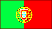
When it came to professional exploration, the Portuguese led the way. First they explored the Central Atlantic, discovering useful islands like the Azores and Madeira. Then they explored the coast of Africa, exploiting that continent's resources while looking for a way to get around it, to reach the riches of Asia. So it should not come as a surprise to the reader that Portugal was also curious about what the North Atlantic would have.
The oldest record we have of Portuguese exploration in the North Atlantic is a fragmentary report from one Jo�o Vaz Corte-Real, who went forth in 1473 and discovered a land he called Terra Nova do Bacalhau (literally, New Land of the Codfish). This could have been Newfoundland, but we don't know for sure; aside from the mention of cod, there is no description of the place. Anyway, if you want to give someone credit for discovering the Grand Banks, the elder Corte-Real is a good candidate for the honor. His sons will play a part in the next generation of exploration.
The Columbus expeditions were a signal that Spain had entered the exploration game. By this time, Spain and Portugual were fierce rivals, and Pope Alexander VI did not want them starting a war over their discoveries, so he called for negotiations to decide what each country could have. The result was the 1494 Treaty of Tordesillas, which drew a north-south line in the Atlantic, and said that for the whole world outside of Europe, Spain could have everything west of the line, and Portugal could have everything east of the line (see more about the treaty here). After the treaty came out, there was speculation over whether the new lands found across the North Atlantic were on the Portuguese side or the Spanish side of the line. In truth, all of North America was on the Spanish side, but since navigators did not have a good way to determine longitude in those days, no one could be sure, and that was enough to get Portugal to send follow-up expeditions.
But first England entered the exploration game, too. So what was the future mother country of the United States and Canada doing when the Age of Exploration began? Well, England was not considered one of Europe's major powers until the battle of the Spanish Armada, in 1588. England did not rule Scotland yet, and only ruled about a fourth of Ireland; England will not call itself the "United Kingdom" or "Britain" until a much later date. At the beginning of the Age of Exploration, both Spain and France had more land, more resources, and more people, meaning they had more potential taxpayers and soldiers. Thus, they also had more money. On top of all that, England spent most of the fourteenth and fifteenth centuries fighting two devastating wars, the Hundred Years War and the Wars of the Roses. As a result, the first king after these wars, Henry VII, saw England's recovery as his top priority. No wonder King Henry said no in 1489, when Columbus came to him and asked him to sponsor his first expedition across the Atlantic.
King Henry regretted his decision, when he heard what Columbus found in 1492. However, another opportunity came along a few years later. This was because many people believed there was a third way to get to Asia, besides the long Portuguese route around Africa and the westward alternative of Columbus. They talked about a "Northwest Passage," and imagined they would find it by continuing along the path taken by the Vikings, past Iceland and Greenland. One of those who believed this was Giovanni Caboto, who like Columbus, came from the Italian city of Genoa. Since Spain and Portugal were not interested--both of the Iberian countries had already blazed paths to riches--Caboto went to England in 1495, where he came to be known by the English version of his name, John Cabot. He gave King Henry new information on Columbus' discoveries, and persuaded the king to finance an expedition, to explore the seas beyond Greenland. Cabot thought that by sailing around the northern shores of the islands Columbus had discovered, he could reach places with real wealth, like China and Japan. The first time he went out, in 1496, bad weather forced an early return, but he tried again in 1497, made it across the Atlantic, and came back. Apparently the king was acting cheap, for he gave Cabot only one ship, the Matthew, with an eighteen-man crew. The expedition's map and journal were lost, so all we know for sure is that Cabot discovered two lands that he called "two new very large and fertile islands."
Unfortunately we have no idea where Cabot made landfall. Did he visit Newfoundland? Labrador? Nova Scotia? New England? He did find the Grand Banks fishery, and while fishermen can be persuaded to keep their mouths shut, explorers are expected to shout their discoveries to the world, so the Grand Banks now became common knowledge, and some history texts give Cabot credit for discovering this fishing spot.
To King Henry, Cabot reported that he had reached the territory of the Great Khan(23), and a second voyage was approved in 1498. Of this voyage even less is known. When they ran into a storm, one ship turned around and made it back to Ireland. The other four ships, including the one Cabot was on, were never seen again; presumably they were lost at sea.
Meanwhile, the king of Portugal granted a patent to explore the lands that belonged to Portugal, according to the Treaty of Tordesillas. The recipient of the patent was Jo�o Fernandes Lavrador; all we know about him is that he was a farmer from the Azores (Fernandes was his family name, Lavrador meant farmer or worker). Accordingly, Fernandes went forth with an unknown number of ships in 1498, and "discovered" both Greenland and the nearest part of Canada -- today's Labrador. At that time, only Scandinavians knew that the Vikings had gone there already. Nor could Fernandes have known that the Vikings planted colonies in the area, and the last of these colonies had failed just a few decades earlier. And the first cartographer to make a map showing the newly discovered places didn't know the Vikings had gone there either; he called them "island of the Labrador" and "land of the Labrador," after the explorer, of course. When it was found out that the Vikings had previously named the island, it became Greenland again, so today the only place named Labrador is Canada's Labrador.
After Fernandes returned, he was given the title to the lands he discovered, making him the first European landowner in North America. Unfortunately, the king also took away his patent to explore, and gave it to the Corte-Real family. We don't know why, but it may have been because Fernandes was a commoner, and as an explorer, he was holding a position more appropriate for someone from the old nobility. Whatever the reason, he didn't like it, and defected to England, going to Bristol. King Henry VII was pleased to get an experienced explorer, and gave him a new patent, so in 1501 Fernandes set sail again, this time to discover lands for England. He was never heard from again. Since neither the Cabot nor Fernandes expeditions brought back precious goods or ambassadors from the Khan, King Henry lost interest in exploration.
But the king of Portugal, Manuel I, wanted to explore some more, so in 1500 he sent Gaspar Corte-Real, a son of Jo�o Vaz Corte-Real, to the same area. On the first voyage Gaspar followed the west coast of Greenland until icebergs forced him back; on the second (1501) he brought three ships and his brother Miguel, and together they went first to Greenland, then Labrador, and finally Newfoundland. There they captured 57 Indians, thinking that they could pay the expedition's costs by selling the Indians as slaves. This was a bad idea, not only because slavery is an evil enterprise, but also because most of the Indians died of Old World diseases, before they ever saw Europe. Miguel brought the Indians back to Portugal on two of the ships, while Gaspar sailed on down North America's Atlantic coast with the third. When Gaspar failed to return by May 1502, Miguel was sent out in search of him; nothing was heard from him, either. A third brother, Vasco Corte-Real, asked King Manuel to let him go search for his brothers, but the king said no; he knew that this was a losing proposition, and by now had realized that the barren lands visited by John Cabot and the Corte-Real family were not part of Asia.
However, Cabot's son, Sebastian Cabot, wanted to go again. A veteran of John Cabot's first expedition, Sebastian made an attempt of his own in 1509, sailing far enough north to touch Greenland. He ventured into both the Davis and Hudson Straits before turning south to follow the coast of Labrador and New England. According to Peter Martyr d'Anghiera, an Italian historian who wrote an account of the expedition in 1516, the younger Cabot went on until he was "almost in the latitude of Gibraltar" and "almost the longitude of Cuba." If these figures can be trusted, Cabot made it as far as the entrance to Chesapeake Bay, before returning to England. Upon his return he found that King Henry VII was dead, and the new king, Henry VIII, wasn't interested in sending out explorers, so Cabot's employment with the English crown ended. Because he did not explore either Hudson Bay or Chesapeake Bay, he must have been convinced that there was no practical northwest passage.
One more expedition is left to be mentioned, the one that signaled France was getting involved. History texts will give Jacques Cartier (see below) credit for being the first European to sail up the St. Lawrence River, but before that could happen, the body of water the river empties into, the Gulf of St. Lawrence, had to be discovered, and again there are several claims for who saw it first. It could have been the Vikings, John Cabot, the Corte-Real brothers, or the various fishermen. We have an obscure report of an expedition by a French explorer, Thomas Aubert, who visited the area in 1508, explored the Gulf of St. Lawrence, and possibly went several miles up the river. He captured seven natives with a birch-bark canoe, and took them back to France, where the king put them on display for the people of Paris to see. What happened to the natives after that is unknown; most likely they didn't live long, due to the lack of sanitation in cities at that time, and their previously mentioned lack of immunity to diseases.
When it came to turning a profit, only the fishermen succeeded. Instead of opening a shortcut to the Orient, Columbus had discovered some islands of dubious worth inhabited by natives whose accumulated stock of gold was exhausted in a few years. As for the explorers in this section, they tried to go around the islands Columbus found, only to run into a continental landmass no one knew anything about. But soon everyone except Columbus would recognize these discoveries were the periphery of a new world; if there was any land besides the places already discovered, it might be rich enough to make up for the lack of gold found so far. Soon rumors of such a treasure-filled country were flying, and the gullible, the greedy and the brave began searching for El Dorado.
![]()
The Conquistadors Who Drew the Map of North America
Among the French fishermen, two groups were involved in special activities. They may have done these activities as early as 1500, and we know they were doing them by 1520. For centuries the Basques had been hunting bowhead and right whales in the Bay of Biscay. When they found out that these whales also migrated along the American coast, they quickly took advantage of the opportunity, by sending whalers to the Strait of Belle Isle (the narrow waterway between Newfoundland and Labrador). Occasionally ice caught the whalers in their shore stations, but they never planned to spend the winter in Labrador; the cold weather killed those who did. The other group of fishermen were those who looked for cod in the Gulf of St. Lawrence. When they went ashore here, they met the local Indians--the Micmac on the southern shore of the Gulf of St. Lawrence, and the Innu on the northern shore--and traded with them. They gave iron tools to these Indians, which they paid for with furs. It was the beginning of an important industry, one that would someday motivate the French to establish a permanent presence in Canada.
Portugal also wanted a Canadian colony for a while. In 1521 the king of Portugal commissioned Jo�o �lvares Fagundes and P�ro de Barcelos to establish permanent colonies in the part of North America that Portuguese explorers had seen, by adding farms to one or more of the Portuguese fishing camps, and bringing settlers to live there all year round. But that is all we hear about the venture. We don't know if any of these colonies got off the ground. If they were founded, we don't know where they were located (Newfoundland and Nova Scotia are the most likely places, but Greenland is also a possibility), or how long they lasted. It's a safe bet that the colonies, if founded, were failures; if they had been successful, we would have heard from them later. Compared with the possible Portuguese colonies, Roanoke (see below) is an open book!
With that, the Portuguese adventure in North America ended. Portugal is a small country, and the fabulous opportunities discovered in Africa, Asia and Brazil meant that Portugal's limited resources were stretched thin, so after this the Portuguese concentrated their efforts elsewhere. Today there are communities of people with Portugese ancestry, in the cities of New England and easternmost Canada. Some of them claim to be descendants of the fishermen who came here, more than five hundred years ago; the rest are immigrants from Brazil. And that is the legacy of Portugal's exploration of North America.
Spanish exploration of North America began with a person who had a proven record: Juan Ponce de Leon, the conqueror of Puerto Rico. De Leon heard a rumor that there was a large island north of Cuba, called Bimini by the Indians (not the present-day Bimini, which is part of the Bahamas). This island contained a "Fountain of Youth," with magic waters; whoever drank from that fountain would never grow old. Leaving Puerto Rico in early 1513, de Leon made landfall in the neighborhood where St. Augustine would be founded, fifty-two years later. It was Easter Sunday, and his crew saw lots of flowers, so they named the land Pascua Florida, the land of Easter flowers. Alas, the local Indians had never heard of the fountain, so he sailed down the east coast of Florida, discovered the Florida Keys, and then went up the west coast as far as Port Charlotte. There he met a hostile Indian tribe, the Calusa, who attacked his ships twice; de Leon got the message and decided to look elsewhere. After leaving Florida, he wandered past Cuba to reach another peninsula, Yucatan. Although he didn't find anything worth taking on Yucatan either, Ponce de Leon's name, if not de Leon himself, became immortal. He was the first European on record to set foot in both the United States and Mexico.(24)
Of course the USA and Mexico as we know them did not exist at this early date, and most of the western hemisphere was still a blank spot on the map, so de Leon never realized what he had done. He thought Florida and Yucatan were just big islands like Cuba, and it might be possible to get to China by sailing between them. The next conquistador to enter the area, Alonso Alvarez de Pi�eda, was sent by the governor of Jamaica in 1519 to look for such a passage. Beginning with Florida, he sailed north, then west, following the Gulf Coast perfectly. He came to grief, however, when he landed in northeast Mexico; Huastec Indians quickly overwhelmed the small force. The survivors, including Pi�eda, were taken prisoner, and sacrificed on a Huastec pyramid (1520). Few explorers have ever suffered an end as inglorious as this, but Pi�eda succeeded in filling a major gap in geographical knowledge. His expedition proved that Florida and Mexico were part of the same landmass, and that there were two American continents, not one. For the past twenty years Spain and Portugal had been sending explorers to South America; now they knew they had a North American continent to explore, too.
Juan Ponce de Leon was another veteran explorer who suffered a grim fate. De Leon returned to Florida in 1521, to claim the "island" of Florida for Spain, by building a fort and maybe a town, so he brought two ships with 200 settlers. Unfortunately he showed that he had not learned enough from his first expedition, for he chose to build his fort in the southwest, right where the Calusa had chased him off last time. The Calusa still didn't want any Spaniards in their neighborhood, and one of them wounded de Leon in the thigh with a poisoned arrow. De Leon ordered everyone back to Cuba, and died there a few weeks later.
As the known portion of America grew, so did efforts to get around it. This was especially true with North America, which the conquistadors found less attractive than Central and South America. The lands north of the Rio Grande just didn't seem to have anything the Spanish explorers and colonists wanted: no gold or silver, no jewels, no spices, and not even enough Indians to work on the farms they might set up.
While Pi�eda was filling in the boundaries of the Gulf of Mexico, Ferdinand Magellan went forth on the first globe-circling expedition. Magellan succeeded in finding a way to the Indies--the real Indies--but this passage, at the tip of South America, was not a very useful one. It was far enough south to see bad weather almost every day, and the route was too long to compete with Portugal's passage around Africa and through the Indian Ocean.(25) If a strait through the Americas was ever going to be worth using, it would have to be at the same latitude as Europe, meaning somewhere north of Florida. Both France and Spain sent ships to explore this unknown area in the 1520s.
One of the crewmen on the Magellan expedition was Est�v�o Gomes. Like Magellan he was of Portuguese descent, but employed by Spain. Gomes (Esteban Gomez in Spanish) was the pilot of one of Magellan's ships, the San Antonio. When they entered the Strait of Magellan, Gomes decided it would be too dangerous to continue, turned the San Antonio around, and took the ship back to Spain. In Spain Gomes was arrested, put on trial, and imprisoned. Normally in those days, the penalty for mutiny was death, but the knowledge Gomes had in his head about South America made him too valuable to kill. The authorities were still trying to decide what to do with him a year later (1522), when another of Magellan's ships returned with eighteen survivors. The story they told about the rest of the voyage was so awful, that Gomes was released.
Now Gomes convinced the king of Spain, Charles V, that Magellan's passage below South America was both too long and too dangerous, and that what they really needed to find was a northwest passage, through the part of North America that had not been explored yet. Therefore King Charles had a ship, the La Anunciada, built for that purpose, with Gomes in command and a 29-man crew. In a nutshell, Gomes not only talked himself out of a death sentence, but also talked himself into a job!
But the French expedition looking for a northwest passage went first. France had a new king, Francis I, who was more serious about exploring than his predecessors had been. The Treaty of Tordesillas really bothered King Francis; he reportedly asked the pope to bring out the will of Adam (the first man), and show what part of the will left most of the world to Spain and Portugal! Then Francis announced that France was entering the game of exploration and colonization, and got away with it by also declaring that he would send clergymen to the places France discovered, to convert any people the French might meet who weren't Christians yet.
To explore North America, Francis first hired an Italian sailor, Giovanni di Verrazzano, and Verrazzano made his first try with four ships in 1523. They lost two ships to a fierce storm and violent seas, and the other two were so damaged that they returned to France for repairs. On the second try, these two ships made it as far as the Portuguese island of Madeira, before one of the ships was declared unfit for further travel and sent home. That left one ship, the Delfina (Dolphin), for the expedition, and Verrazzano headed west with it in January 1524. Before summer ended, he returned with the bad news. Starting at North Carolina's Cape Fear, he first went south, following the coast of Georgia; then when he reached Spanish Florida, he turned around, and followed the coast of the continent northward all the way to Newfoundland. Nowhere did he find anything that looked like a passage. In fact, he didn't even try very hard; most of the time he stayed a few miles offshore and the only places where he dropped anchor were New York Harbor, Narragansett Bay, and Maine's Casco Bay. This caused him to completely miss Chesapeake Bay, Delaware Bay, and the Bay of Fundy, all of which would have looked like the beginning of the sought-after passage. Where Verrazzano made his mark was in his expressed opinions. He remarked that New York Harbor would be a great place to build a port, prompting today's New Yorkers to name a bridge after him. In Narragansett Bay he said that nearby Block Island looked a lot like the Greek island of Rhodes, so we've called it Rhode Island ever since. Finally, Verrazzano named the land that he explored Francesca, in honor of King Francis, but his brother's map gave it a different name, Nova Gallia. Those of you familiar with Latin will know that Nova Gallia means New Gaul, and that Gaul was the Roman name for France. Thus, it would be a small step to go from Nova Gallia to the future French name for their North American colony, New France.
Verrazzano seems to have known the coastline he was sailing was a solid one, but he told the French king otherwise. He reported that there were many openings through the Carolina Banks, and he could see nothing but water on the other side. Could this "Sea of Verrazzano" be the Pacific Ocean? Verrazzano had seen the Venetian Lagoon, so he must have known the answer was no. The fact that he wasted no time exploring the inlets and sand bars of the banks tells us that he didn't really think there was a passage here. Presumably he was trying to get the king to hire him for another mission. If so, he failed; only a few cartographers took his "sea" seriously, and France sent no follow-up expedition to the Carolinas.
Meanwhile in the Spanish empire, the mover and shaker for North America at this date was not a conquistador, but a wealthy lawyer, Lucas Vasquez de Ayllon. In 1521, Ayllon hired Francisco Gordillo to go looking for slaves in the vicinity of Florida. Gordillo left Santo Domingo (Spain's capital in the Caribbean), and at Great Abaco in the northern Bahamas, his caravel met another one, belonging to a friend, Pedro de Quexo. Quexo had heard of a mysterious "island of giants" in the north, so the two pilots decided to explore together. Sure enough, they reached land on the feast day of St. John the Baptist, so they called it the "Land of John the Baptist." Nearby was a river which they christened the Jordan (South Carolina's Santee River?), and an Indian village. These Indians were unusually tall, and the visitors traded for three weeks; then they suddenly seized sixty natives and headed home. On the way Gordillo's worn-out ship sank, so his captives and crew had to be crowded aboard Quexo's vessel.
At Santo Domingo most of the Indians died quickly, of course. One who didn't said the name of his land was Chicora, so Ayllon named him Francisco de Chicora. Then Ayllon went to Spain to get an official claim to the new land, taking Francisco with him. Upon his return he sent two more caravels, to survey the land that was now his.
The first caravel was the one commanded by Est�v�o Gomes. It left Spain in September 1524, eight months after Verrazzano started. After a stop in Cuba, the ship, like Verrazanno's, sailed up the North American coast. Unfortunately we have no written account of the voyage, only a map, so it is not clear how far Gomes went beyond Maine, before he turned east to return to Spain. Historians have even disputed whether he went from north to south, or south to north. What we do know is that he entered New York Harbor and the Hudson River (which he named the "San Antonio River"), and he thought that Maine's Penobscot River could be the passage. In Maine Gomes also tried to make the expedition pay, in the same way the Corte-Real brothers had; he kidnapped more than 50 Abenaki Indians and took them back to Spain. Upon arrival he announced that he had slaves to sell, and due to differences in the Spanish and Portuguese languages, the potential Spanish customers misunderstood him, thinking he was selling clothing. When they found out he was selling human beings, they turned away in disgust; King Charles was also reportedly horrified and ordered the natives set free. As a result, Gomes had nothing to show for his efforts.
The other caravel was also commanded by someone we have met already, Pedro de Quexo. Quexo's discoveries were somewhat more useful. Starting in the south, he went from Georgia to Virginia, proving that Ayllon's land was joined to Florida. In the north Quexo discovered Chesapeake Bay and called it the "Bay of the Mother of God." His voyage persuaded a cartographer named Juan Vespucci (Amerigo's nephew) to make a map of America that labeled most of the southeastern U.S. "The new land of Ayllon."
Ayllon himself arrived at the Carolina coast in 1526, with six ships and 500 colonists. His flagship ran aground and sank in the mouth of the Jordan River, taking most of the supplies with it. Then Francisco de Chicora showed how pointless it was to civilize him; as soon as he realized he was home, he disappeared into the bushes. Ayllon decided to move down the coast 150 miles, and set up a settlement named San Miguel de Gualdape. However, his fortunes were no better here. Autumn storms, disease and Indian attacks soon killed off 200 Spaniards; then on October 18, Ayllon died. The African slaves brought by the colonists launched a wild mutiny that night, which burned so many houses and killed so many men, that the survivors had no choice but to abandon the colony.(26) Of them, a hundred and fifty made it back to Santo Domingo. The only accomplishment of the expedition was to give the Carolinas the name "land of Ayllon" for the next fifty years.
Verrazzano led two more expeditions across the Atlantic, but the ships and funding came from private citizens, not from the crown. In 1527 he took four ships on the second expedition; one ship was separated from the others by a gale, but the other three made it to Brazil. Because the Portuguese had already explored the Brazilian coast, Verrazzano made no new discoveries here, but the expedition turned a profit by bringing back a valuable cargo of brazil-wood. The final expedition was sent out in early 1528, again to look for a passage. This time they explored the coast of Florida, the Bahamas and the Lesser Antilles, presumably to see if Spain had overlooked a passage in the Spanish-claimed part of the Americas. Instead, on an unidentified island, possibly Guadeloupe, Verrazzano went ashore with a small party to meet the local Indians, the Caribs. The natives responded by attacking the group, killing and eating them all! The rest of the crew, which included Verrazzano's brother Girolamo, could only watch with horror; they were anchored out of gunshot range, and could not come to the rescue in time.
The next Spaniard who tried was a one-eyed soldier, Panfilo de Narvaez. In Florida he made so many mistakes that his experience became a lesson in how not to start a colony (1527). First he landed 400 men in Bahia Honda (Tampa Bay), and immediately sent away the fleet before the settlement was firmly established. Then when he saw that the local Indians had some gold ornaments (no doubt merchandise they had received by trading with a distant tribe), he attacked them, instead of intimidating or befriending them. Because they had not brought much food, the Spaniards also ransacked Indian villages for corn, and the Indians struck back accordingly. Forced to pull out of the neighborhood, Narvaez and his party went to the Tallahassee Hills, where they thought the Indians had gotten their gold, and marched aimlessly in West Florida for the next four months. By the time they found the Gulf of Mexico, illness and Indian attacks had cut the size of the expedition in half. The 200 survivors decided to leave Florida altogether, and built five long canoes, hoping they could sail westward around the Gulf to Mexico. They misjudged the distance involved, and Narvaez was lost in a storm. The farthest any of the boats got was Texas, where two were wrecked near Galveston Island in 1528.
![]()
The Seven Cities of Gold
Nobody in New Spain expected to see any of Narvaez's followers alive again. Imagine the surprise in 1536, when a slave-raiding party went to the Sonora River in northwest Mexico, and came back with four survivors from the Narvaez fiasco! The leader of the emaciated quartet was Narvaez's second-in-command, Alvar Nuñez Cabeza de Vaca, a noble whose grandfather had conquered the island of Gran Canaria. The others were Captain Alfonso de Castillo, Andrés Dorantes, and a black Moroccan named Esteban. Cabeza de Vaca reported that life was hard for the tribes of the Texas coast, who were always in danger of starvation. "The famine," he recalled, "is so great that they eat spiders and the eggs of ants, worms, lizards . . . the dung of deer . . . Were there stones in that land they would eat them."
The four were separated at first, and treated as captives by the Indians. As Cabeza de Vaca put it, "I was in this country nearly six years, alone among the Indians, and naked like them." They survived by using their wits and their bartering skills, while learning as much as they could. In 1534 they found each other, and when the tribes gathered at the Yupe River for the summer cactus harvest (their main holiday), they escaped. In the course of looking for Mexico, they journeyed all the way across the continent, from Texas to Sonora, but understandably they could not record the path they took on this astonishing trek. Fortunately, they entered more fertile lands west of the (Texan) Colorado and Pecos Rivers, where corn-growing people lived in "fixed dwellings." Because the party knew a bit of European medicine, they gained acceptance as wandering medicine men, received buffalo robes and were soon welcomed with celebrations wherever they went.
In the Sonora valley, Cabeza de Vaca saw an Indian wearing a Spanish horseshoe nail as an amulet, and knew they were headed in the right direction. Not long after that, the four were picked up by the slavers and taken to Mexico City, where they were questioned by Hernando Cortez and his viceroy, Antonio de Mendoza. All the tribes they had seen were dirt poor; however, they had also heard rumors of tribes in the north who had cities and were much richer. So maybe North America had gold and silver after all.
The conquistadors had heard stories like these already. After Hernando Cortez looted Tenochtitlan, the capital of the Aztecs, rumors circulated about the Indians to the north living in seven cities, each of them as big as Tenochtitlan, and they were so wealthy that even poor families cooked their food in silver pots. Spaniards called these cities "the Seven Cities of Cibola," after an old legend which claimed that in the Middle Ages, a Spanish priest had sailed across the Atlantic to escape the Moorish invasion of Spain, discovered a new land, and founded an incredibly wealthy kingdom there. However, the conquistador who explored northwest Mexico in the 1520s, Nu�o de Guzm�n, failed to find any of the seven cities, and that's where things stood until Cabeza de Vaca turned up.
The official response to de Vaca's report was to send two more conquistadors in search of the cities of gold, Hernando de Soto and Francisco Coronado. De Soto, the governor of Cuba, went first, taking 570 men to Tampa Bay in 1539. He had traveled with Francisco Pizarro, the conqueror of Peru, brought back a fortune from South America, and was a thoroughly ruthless leader; if there was anything worth taking in North America, he would be the one to find it. Instead, he spent three years wandering through Florida, Georgia, the western part of the Carolinas, Tennessee, Alabama, Mississippi and Arkansas. He squeezed some supplies out of the Indians he met, but found the land too underpopulated to support any kind of city.(27) Nor did the Indians have any gold or silver. In 1542 he discovered the Mississippi River, and called it "the Father of Waters"; shortly after that he died of a fever and was buried in the river. Before the end, he must have realized that this was a fruitless chase. His men tried to cross Texas, turned back, headed down the Mississippi and followed the Gulf coast to Mexico. Surprisingly, more than 300 of them made it.
In February 1540 Coronado marched north from Mexico with 400 Spaniards and 1,300 Indian auxiliaries, a large army by New World standards. Unlike de Soto, Coronado thought he knew exactly where the cities of Cibola were. He sent two scouts ahead of the main party: Esteban, the black companion of de Vaca, and a Franciscan missionary named Brother Marcos.
They got off to a great start. Esteban did his medicine-man act, and it so impressed the Indians he met that they sent him on to the nearest "city" they knew of, a Zuni pueblo called Hawikuh. Unfortunately, the Zuni did not fall for it. When this black man told them about white gods, they killed him, figuring that he must either be an enemy, or dangerously insane. Brother Marcos returned to tell Coronado's men. He also reported that he had followed Esteban to Cibola (his name for Hawikuh), and though he did not enter the city it looked rich enough to be one of the legendary places they seeked. The expedition entered Arizona in high spirits.
Their good mood did not last long after they reached Hawikuh. They had marched a thousand miles, expecting to sack something like the treasure houses of the Aztecs, and instead they found a miserable little pueblo, whose wretched inhabitants didn't have enough gold between them to make a single piece of jewelry! The unlucky soldiers wanted to have a few words with Brother Marcos, but even here they were disappointed. The talkative little friar saw how things were going, and hurried back to Mexico before anyone could stop him.
Coronado refused to be discouraged. Before leaving Mexico, he had sent part of his party up the coast; they made it to the mouth of the Colorado River. Another one of his lieutenants went due west from Hawikuh, passed through Hopi country, and discovered something truly amazing, the mile-deep Grand Canyon. As for Coronado and the main force, they found a cluster of pueblos on the upper Rio Grande; then they continued for several hundred miles across the Great Plains, becoming the first Europeans to see the tepees of the buffalo-hunting tribes. All three groups had made important geographical discoveries, but the natural wonders they found didn't make money for anyone. Coronado returned to Mexico to find that his expedition had been declared a failure, because it did not produce any revenue.
Exploring the southwest by sea proved equally unrewarding. Francisco de Ulloa, a lieutenant of Hernando Cortez, charted both sides of the California peninsula in 1539-40. Two years later another explorer, Juan Rodriguez Cabrillo, took two ships up the Pacific coast as far as Bodega Bay. Here much of the shore was hidden by fog, and it kept Cabrillo from finding the west coast's most splendid harbor, San Francisco Bay. When winter came, he pulled back to San Miguel Island (next to modern Santa Barbara), and succumbed to an old wound. Bartolomeo Ferrer took command of the expedition, and headed north again the following spring. He reached a point near the California-Oregon border before turning back for Mexico (1543). On the return trip he took such a fearful battering from stormy seas that no one else wanted to repeat the exercise. Because of that, one of the most desirable places to live in today's world was ignored for the next two hundred years.
![]()
Cartier's Misadventures
It wasn't only in the Spanish portion of North America where sixteenth-century history has largely been forgotten. That was also the case where the French explored. The only story still taught in most history books is one more tale of failure, the first French attempt to set up a colony in Canada. This story began in the province of Brittany; in the past that province, with its distinct Celtic population, had been seen as only a peripheral part of France. Most of the time it was autonomous, until a 1532 treaty, the Union of Brittany and France, declared that Brittany belonged to France as much as any other province, and that every king of France after Francis I would be duke of Brittany as well. Now in 1534, two years after the treaty, Saint-Malo, a fishing community in Brittany, was preparing an expedition to the Gulf of St. Lawrence. It would be commanded by Jacques Cartier, an experienced sailor who had already been on ships going to Newfoundland and Brazil. Well, the bishop of Saint-Malo arranged for a meeting between Cartier and King Francis, and the king said he would pay part of the expedition's cost, if it would look for a passage to Asia. In that way, a private expedition became an official, royal-sponsored one; that's why we know about it today.
Cartier went forth with two ships and 61 men, in April of 1534. He first made landfall at Newfoundland, after taking just twenty days to cross the Atlantic. So far, so good. He started exploring by following the north and west coasts of that island, and found it had hardly any trees or soil; most of the ground was covered with rocks and moss. To Cartier, Newfoundland was so bare that he wrote, "I am rather inclined to believe that this is the land God gave to Cain." Then the ships sailed southwest into the Gulf of St. Lawrence, where they discovered Prince Edward Island, the Magdalen Islands and Anticosti Island, and explored the coasts of New Brunswick and Quebec's Gasp� Peninsula. The Magdalen islands were called the �les aux Oiseaux (Islands of Birds) because they were teeming with bird life; Cartier's crew killed 1,000 of them (mostly great auks, which are now extinct).
When they reached New Brunswick, they had two encounters with natives, probably from the Micmac tribe. The first encounter went well enough; the natives were friendly and some trading took place. They must have spread the word that white men were in the neighborhood, because at the second encounter, the natives surrounded the French with forty canoes. Fearing this group of Indians was going to attack them, Cartier's crew fired two warning shots from the cannon on the ships, to scare them away. In truth the Indians were just overenthusiastic; this group wanted to trade, too, and they showed it by holding up sticks with animal skins on them.
The third and most important encounter with natives took place on the Gasp� Peninsula, for here was the first meeting between Europeans and members of an Iroquoian tribe. These natives came from a village on the St. Lawrence River, which they called Stadacona (modern Quebec City), and they were here to fish and hunt for seals. Cartier traded with them until July came around, when he realized that they needed to leave before summer ended, in order to get back to France while the weather was still good.
Before they began the homeward journey, Cartier planted a 33-foot-high wooden cross at Pointe-Penouille, that bore the words, "Long Live the King of France." The local chief, Donnacona, correctly guessed that the cross was an attempt by Cartier to claim that land for his people. He shouted a lot at the cross, but because of the language barrier, all Cartier understood was that Donnacona was offended by the new addition to the landscape. He managed to placate the chief with some gifts, and then when the ships cast off, Cartier took the chief's two sons with him. Although we have the names of the youths (Domagaya and Taignoagny), it is not clear how Cartier acquired them. One version of the story claims that he simply kidnapped them, and was planning to teach them French so they could act as interpreters on future trips. Another version suggests that Donnacona let Cartier have the boys, after he promised to bring them back the following spring, along with plenty of trade goods. Whatever happened, Cartier arrived back at Saint-Malo, France on September 5, 1534.
Cartier had failed to find gold or a passage to Asia, but the land and his relations with the natives were promising, and he emphasized that when he told the king about the voyage. The king agreed, and sponsored another expedition; this time Cartier would have three ships, 110 men, and enough supplies to last fifteen months. By May of 1535 they were ready to go. Crossing the Atlantic, the ships were separated by bad weather, and they had to reunite off Newfoundland before the expedition could continue. Using the chief's sons as guides, they located the St. Lawrence River and sailed up it.(28) Finally, they reached the village of Stadacona in September.
Needless to say, Chief Donnacona was delighted to get his sons back, and allowed the French to enter the village. He also proposed that henceforth, instead of trading with whoever they met, the French should trade exclusively with Stadacona; this would give Stadacona an advantage over the tribes it didn't get along with. However, Cartier noticed that Donnacona was already involved in a luxury trade network among the Indians, who mined raw copper somewhere inland and sent it east, where it was traded for seashells. When Cartier asked where the copper came from, he was told it came from a kingdom called Saguenay. By now Cartier had realized that the St. Lawrence could not be the Northwest Passage. Originally he had hoped the St. Lawrence would lead him to an inland sea, a New World version of the Mediterranean, and then he could sail on that to Asia. Instead, the St. Lawrence turned out to be just another river; if he followed it to its source he would come to a lake, a mountain stream, or a spring, and he would be no closer to Asia than before. However, copper is a thoroughly useful metal, and the discovery of copper mines would be a valuable consolation prize.
Cartier asked more questions, and found out that if he continued up the river, he would first come to another village named Hochelaga, whose residents were allies of Donnacona, but not under his control. Thus, Cartier decided that he must visit Hochelaga next, and that was just what Donnacona didn't want. The chief proposed an alliance between Stadacona and the French, and tried to talk Cartier out of moving on. When that didn't work, Donnacona pulled a trick; he had some natives dress up in dog skins and wear hideous makeup, to make them look like inhuman monsters, and they staged a fake attack on the village from canoes. After the Stadacona warriors won the fake battle, Donnacona told Cartier that the "invaders" were from Hochelaga, and he definitely shouldn't go there. Cartier saw through the trick, and went anyway. He had to go without interpreters, though, because the sons of Donnacona obeyed their father, and stayed at Stadacona.
At Hochelaga the residents were also Iroquoian, and they gave Cartier another warm welcome. Next to the village was a small mountain that Cartier named "Mount Royal." In French this was spelled Montreal, and that is how the future city built on that spot got its name. When Cartier climbed the mountain, to get a look at the surrounding countryside, the natives suddenly began touching the metal objects he was wearing, like the gold chain and the hilt of his dagger, and pointed west. This got Cartier thinking that not only was the kingdom of Saguenay in that direction, but it had precious metals as well as copper. It is more likely the natives thought the gold and silver objects were made from another kind of copper; to a tribe that doesn't know how to work metals, metal is metal, after all. Alas, it was fall already, and Saguenay would have to wait for another year's exploration.
Cartier returned to Stadacona, and found the men he left behind were building a stockade, because they knew they were going to have to spend the winter there, and relations with the Stadacona natives had cooled. Cartier was especially alarmed to see that Donnacona had brought in new natives, strangers from beyond the village; he suspected Donnacona would use them to attack the French. As winter began, the natives and the French hunkered down in two separate camps. Scurvy broke out in both camps, and for a while it looked like everyone would die that winter. One of those afflicted with scurvy was Domagaya, the chief's son, and the French thought he was a goner, so when they saw him walking around outside the native camp a few days later, they asked him why he was still alive. Domagaya took them into the forest, gathered leaves and bark from a tree he called annedda (white cedar), and made a tea by boiling the leaves and bark in water. Well, scurvy is a disease caused by not having any vitamin C, and though the Indians didn't know it, cedar tea provides just enough vitamin C to start a patient on the road to recovery.
Spring arrived late; the ice around the ships did not break up until mid-April. Although 85 of the French had survived, thanks to the cedar-tea secret, they had lost enough men that they chose to abandon one of the ships. When Donnacona saw them getting ready to leave, he told Cartier that a rival named Agona was trying to replace him as the local chief. Indeed, the real reason why Donnacona had brought strangers to the village was to strengthen his own faction within the tribe. Since Cartier would want to take some natives when he departed, why not do the chief a favor, and take Agona? Cartier pretended to agree, and invited Donnacona to bring Agona to the French camp the next day, when they were observing a religious holiday, the feast of the Holy Cross (May 3). On the next day, when the natives showed up, Cartier gave an order, and his men seized Donnacona, his sons, and some other natives. The rest of the village was naturally upset by this treachery, but Cartier assured them that Donnacona would come back in 12 moons, laden with gifts, after he told the king of France about the marvels of Saguenay. Then he topped all this off by planting a second cross before leaving. In that way Cartier brought back ten Iroquois, landing at Saint-Malo on July 16, 1536, and the way was clear for Agona to become the new chief of Stadacona.
Jacques Cartier had taken Donnacona because he thought King Francis would be interested in hearing about the New World from a native aristocrat; by now he was calling Donnacona "The Lord of all of Canada." The king was interested, and he had his men question the chief. By now Donnacona had figured out that the French wanted precious metals more than anything else, so he told them the wildest stories he could think of about the kingdom of Saguenay. He said it had lots of gold, silver and copper, that the people living there were light-skinned like Europeans, that other people had wings like bats, and so on. By the time he was done, the French were thinking that Saguenay was a fabulously rich empire, like the ones Spain found and conquered in Mexico and Peru. The king then gave the chief a place to live in Paris, with a nice pension. However, France was at war with Spain at this time, and it would not be safe to send another expedition until the war ended.
King Francis gave the order to prepare a third expedition in October of 1540. The French were not going to look for a Northwest Passage anymore; instead, the goals of this expedition would be to (1) look for Saguenay, and (2) plant a permanent colony. By planting boots on the continent, the French claim to part of North America would outweigh the Spanish claim to all of it. To start the colony, Cartier would have his largest force yet: five ships, 1,500 men, and two years worth of supplies. By the standards of that time, this was a stupendous commitment; compare it with the 100 or so colonists that went forth to found Jamestown and Plymouth in the next chapter. However, in January 1541, the king made one major change. A venture as important as this would need to be led by a high-ranked nobleman, and the one the king put in command was Jean-Fran�ois de La Rocque, Sieur de Roberval. Roberval would thus become the first viceroy or governor of New France. Cartier would be the number two man in the colony, but he would still have to do most of the work, while Roberval would get the credit. Unfortunately, Roberval was an army officer, meaning he did not have any of the skills needed to make this expedition a success. Roberval wasn't even ready to go when Cartier was ready (May 1541), so he told Cartier to go ahead with his ships; he would follow when he had everything he needed. Another bad sign for the future was that a lot of the colonists were convicts from the prisons of France, because Cartier and Roberval could not find enough volunteers to fill the ships; these individuals were not only likely to cause trouble, they also did not have useful skills for professions like farming and carpentry.
For this voyage, the winds were not favorable; it took three months for Cartier to cross the ocean. He finally reached Stadacona in August 1541. Naturally the natives wanted to see their relatives that Cartier had taken away, five years earlier. Cartier did not bring any of them back, because they had died in France of the Old World diseases they caught; the only one still alive was a little girl, whose name has not come down to us. Cartier announced to the new chief, Agona, that Donnacona was dead, but then lied about the fate of the rest; he said that the others were living there as great lords, and that they were married and did not wish to come back. This news did not cause Chief Agona any grief; he wanted to believe it was true, because if it was, there would be no challenge to his rule.
Cartier decided that the French would wear out their welcome if they built the colony too close to the village, so they continued a few miles upstream, to a point near where the Cap-Rouge River flows into the St. Lawrence. The surrounding cliffs and hills made this a defensible spot; Cartier founded the colony here, and named it Charlesbourg-Royal, after Charles, the third son of King Francis. The colonists disembarked from the ships, the cattle that had survived three months aboard were turned loose, two forts were built to protect the settlement, and gardens were planted with cabbage, turnip and lettuce seeds, though the growing season was almost over. Before long the colonists noticed gold flakes in the ground, and gathered them; others dug up crystals that looked like diamonds. When they found enough of these minerals, Cartier had them loaded on two of the ships, and sent them back to France. It looked like the colonists were going to be rich.
Once everything was going well in the colony, Cartier decided it was time to pay another visit to the other Iroquois village, Hochelaga. After the Hochelaga natives welcomed him, Cartier let them know that he was looking for Saguenay, and wanted guides to take him to the place. They went upstream for a few more miles, only to find their way blocked by rapids. Today these are called the Lachine Rapids. Cartier asked what lay beyond the rapids, and was told more rapids, so deciding that Saguenay did not exist, he gave up the quest, and returned to Charlesbourg-Royal, now determined to spend another winter in Canada.
Back at the settlement, relations with the natives had turned ominous. The natives no longer made friendly visits or gave them food and furs; instead they were prowling outside the colony in a sinister manner. They would have needed to outnumber the settlers, in order for a direct attack on the colony to succeed, but they could pick off individuals who left the safety of the settlement to fetch water or firewood. Over the course of the winter, they did just that, ambushing and killing 35 settlers.
By the time winter became spring, morale was falling, and there still wasn't any sign of Roberval and his promised reinforcements. Cartier decided that staying there any longer would be a losing proposition, and the settlers agreed with him. So in June 1542 they all boarded the three remaining ships to go back to France, after loading the ships with the gold and diamonds they had found since the other two ships left. They made it down the St. Lawrence to the Atlantic, and were in the neighborhood of Newfoundland, where along with the expected fishing boats, they met Cartier's boss, Jean-Fran�ois de La Rocque, Sieur de Roberval, with three ships and 200 new settlers!
Roberval was now a year late; where had he been all this time? Well, Roberval owed a lot of money to other nobles, and was desperate to pay off these debts. To make the money he needed, Roberval had been acting as a privateer, a pirate going after ships belonging to the enemies of France, especially English ships. Nobody could tell Roberval how much he could make by founding a colony, so he pursued a career that he knew paid well -- piracy. It was only after he did this for a year that he decided it was time to follow Cartier to the west, with the delayed follow-up expedition.
Roberval chastised Cartier for abandoning Charlesbourg-Royal, and ordered him to return to the colony. But even Roberval's presence could not change the minds of Cartier and his colonists. That night they slipped away from Roberval, and continued their homeward journey. They arrived in October, and this is the end of the story for Cartier; he would never leave France again. Alas, the minerals loaded on Cartier's ships were almost worthless. The "gold" turned out to be iron pyrite, also known as "fool's gold." And the "diamonds" were just quartz crystals, which gave rise to a French expression: "faux comme les diamants du Canada" ("As false as Canadian diamonds").
Meanwhile, Roberval took command at Charlesbourg-Royal, and his settlers moved in. Unfortunately, they didn't bring enough supplies to get them through winter, the way Cartier had done. The winter of 1542-43 caused them to suffer the same hardships -- disease, boredom, foul weather and hostile natives. At least a third of them died from scurvy. In spring Roberval made his own attempt to find Saguenay, and was halted by the same rapids that had stopped Cartier. Thus, Roberval and the remaining settlers came to the same conclusions as Cartier did. By September 1543, they were also back in France. It would be another fifty years before any Frenchmen (besides the fishermen) were interested in Canada again. And Charlesbourg-Royal would be forgotten; today's archaeologists only found its location in 2006.
![]()
The Cross and the Sword
In 1559 Tristan de Luna y Arellano led 1,500 Spanish soldiers and settlers to Florida's Pensacola Bay, where he established a colony named Santa Maria de Ochuse. About fifty miles inland (in Alabama), an Indian village named Nanipacana became an advance base for the colonists. However, this effort was ruined by lack of supply. A storm wrecked de Luna's fleet, and two years later Angel de Villafane arrived to rescue the survivors.
The losses and bad luck of Europeans in North America was truly discouraging; all attempts to colonize the continent had failed. This was especially disappointing to Spain, after the roaring successes Spain had enjoyed in the Caribbean, Mesoamerica and South America. Many Spaniards, like the new king, Philip II, now thought that further activity north of the tropics would only waste more money and lives. However, others now took an interest in the region. By the middle of the 16th century, many non-Iberian Europeans, especially Protestants, began thinking that they could stake a claim to any territory Spain and Portugal hadn't occupied already. And because no natural barrier had been found between New France and Spanish Florida -- no middle sea, no mountains and no major river -- it might even be possible to put a French or English colony in Florida.
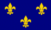
On May 1, 1562, another European ship appeared off the coast of Florida. This vessel belonged to France, not Spain; her captain, Jean Ribault, didn't sail under the orders of any king, either. Ribault was a Huguenot, a French Protestant. Europe at this time was engulfed in the commotion of the Protestant Reformation and the Catholic response, the Counter-Reformation (see Chapter 5 and Chapter 6 of my history of Christianity). It was an age that knew no quarter, when people could get killed just for attending the wrong church. Ribault was in America to find a place where his co-religionists could live and worship in peace. But unlike the Pilgrims who would come over in the next century, the Huguenots wanted more than just religious freedom. They also wanted to prove their loyalty to the French crown, and believed that if they could plant a successful colony in the New World, they would win the acceptance of France's Catholic majority. The first Huguenot colony was planted in Brazil, and called La France Antartique, but that is a subject for another page on this website.
Back to Jean Ribault. On May 1, 1562, he made landfall on the coast of what is now northeast Florida, at the mouth of the St. Johns River, and called it the River of May. This immediately looked like a better place for a colony than Canada. Here the climate was subtropical, so the French wouldn't have to deal with bitterly cold winters, and the growing season lasted long enough to grow two, maybe even three crops per year. There were rumors floating around at the time, which asserted that the people living in Florida were giant cannibals, but instead the tribe Ribault met, the Timucua, were friendly, and they brought gifts of food to the newcomers. Because the Spaniards sometimes raided native communities, the Timucua were delighted to meet another "tribe" of Europeans, one that treated them better. And because they knew that Europeans wanted precious metal more than anything else, they told the French about a place named the "Apalatchy Mountains," where the natives had gold and silver, and if the French would make an alliance with them, the Timucua would show them where this place was. This rich tribe could have been the Cherokee, if the Timucua didn't make up the whole story.
From Florida, Ribault sailed up the Atlantic seaboard until he found a spot he liked, Parris Island in South Carolina. There he founded a fort named Charlesfort (after the French king Charles IX), put a garrison of 30 men in it, and left to tell France the good news, after promising to come back with supplies within six months. Unfortunately for Ribault, a war broke out in France while he was away. This was the first of nine civil wars between Huguenots and Catholics, the so-called "Wars of Religion," that would keep France busy for the rest of the century. Ribault returned to find his home port, Dieppe, under siege from a Catholic army. He took part in Dieppe's defense, and when it fell, he fled to England.
Queen Elizabeth I, being a Protestant herself, was very interested in Ribault's story, and offered to send him back to Charlesfort with some English ships, carrying the provisions Charlesfort needed. Such an offer, if accepted, would have effectively handed over the outpost, and possibly all of North America, to England. Ribault pretended to accept, tried to escape when he got the ships, but the queen had him arrested and thrown in the notorious Tower of London.
Across the ocean, Charlesfort languished. Most of the settlers were nobles and soldiers, meaning that like the settlers in Cartier's colony, they did not have skills useful for starting a colony, so they could not grow enough food to feed themselves. One day the storehouse they had built burned down, taking their food supply with it. And while the natives had greeted them with food at the first encounter, they weren't willing to feed the colony indefinitely. The fort's commander, Captain Albert de la Pierria, became homicidal; he hanged one man by his own hands and had another, a crewman named La Ch�re, marooned on an island, to suffer a slow death by starvation. When 1562 became 1563 and the promised supply ship did not show up, the exasperated men killed Captain Albert in a mutiny, named Nicolas Barre as their new leader, and built a boat to take them back to France. Because none of them had experience at shipbuilding, what they built was a pitiful construction of pine logs, held together by vines and some rope donated by the natives, with moss to plug the gaps between the logs. For sails, they used bedsheets and parts of their clothing.
Once the boat was finished, everyone climbed aboard except seventeen-year-old Guillaume Rouffi, who said he would rather take his chances with the Indians. He did the right thing, for the Indians took him in. As for the overcrowded lifeboat, it got off to a promising start, then was becalmed in the Atlantic for twenty-one days. Of course the boat wasn't seaworthy, and the men had to bail out seawater around the clock to keep it from sinking. On the way, the men also ate items made from leather, drank their own urine, drew lots to see who must die for the sake of the others, and killed and ate the one who drew the unlucky number. Ironically, the victim was Mr. La Ch�re, the same man who had previously been sentenced to die of starvation. Finally an English patrol ship found this boat of horrors drifting off the coast of Europe, her crew too weak to land without help. In August Queen Elizabeth interviewed the recovered Nicolas Barre and sent him to the Tower of London, too.(29)
France's first "War of Religion" ended after a year, so Rene Goulaine de Laudonniere, Ribault's lieutenant, crossed the Atlantic in 1564 with three ships, 300 men and some women, four of which came with their husbands; all were ready to make a second attempt at building a Huguenot colony. Meanwhile in Spain, King Philip loathed heretics, so he sent 25 men and a fighting caravel from Havana, commanded by Hernando Manrique de Rojas, to destroy Charlesfort; they did not know it had already been abandoned. Rojas reached the Carolina coast on June 12, and the Indians brought Guillaume Rouffi to him. Rojas interrogated the young Frenchman, forced him to give directions to Charlesfort, burned what was left of the settlement, and returned to Havana, thinking he had destroyed the French presence in America. A few days later, Laudonniere sailed up the St. Johns River, dropped anchor and built Fort Caroline, within the city limits of modern Jacksonville. This location, a few miles inland, would make the fort invisible to Spanish ships patrolling along the coast.
Fort Caroline, like Charlesfort, was named after the French king, Charles IX. Near the fort, the Timucua tribe had several villages, and one chief, a man named Saturiwa, ruled thirty of them. The French met Saturiwa when they arrived, he and Laudonniere exchanged gifts, and the French noticed that these natives had silver ingots among their possessions. Saturiwa told Laudonniere that the hills to the west contained gold and silver, but they were controlled by enemies of his. If the French would form an alliance with Saturiwa, his natives would assist in the building of the fort, and after they defeated the enemies in the west, the French could take the gold and silver from there. Laudonniere, not knowing how native alliances worked, agreed to these terms.
Soon after that, Saturiwa announced he was going to war against Utina, the chief of the villages to the southwest, and invited the French to join him; Laudonniere refused, because construction on Fort Caroline wasn't done yet. the men got involved in a war between two Indian tribes in the neighborhood; then they began lusting after gold and silver, and tried looking for the "Apalatchy Mountains." Consequently they failed to prepare for the upcoming winter, and when it arrived, the colony was faced with starvation. Laudonniere got the blame for this hardship. When he discovered that some discontented colonists were plotting to blow him up with a keg of powder, thirteen rebels took off with a small boat. They made it to Cuba and captured a Spanish ship, dramatically announcing that the French were back in the Americas.
A few weeks later, 66 more mutineers stole a ship. They also headed for the Caribbean, where they intended to land on Christmas Eve and "enter into the Church while Mass was sayd after midnight, and to murder all those they found there." Instead they encountered a Spanish fleet, and 40 were killed in the resulting battle; the rest, however, managed to capture a Spanish brigantine and escape with it. Then they returned to Fort Caroline with their prize. If they expected mercy from Laudonniere, they were terribly mistaken; he shot the leaders and hung their bodies on gibbets.
After that weeks went by without relief for starving Fort Caroline. In August of 1565, four English ships arrived. The commander was John Hawkins, an enterprising merchant who made a living by selling slaves to the Spanish colonies, an illegal business that was both very risky and very profitable. He and Laudonniere made a deal; Hawkins would leave one of his ships and 50 pairs of shoes behind for some cannon and powder. The desperate colonists were planning to use the ship to go back to France, but the winds blew the wrong way for several days. While the colonists waited for a fair wind, seven more ships came in. Jean Ribault had finally escaped from England's Tower dungeon, and was in command of the long-awaited supply fleet.
Philip of Spain was furious when he heard that the Huguenots had another outpost in his overseas empire. This time he sent one of his best captains, Don Pedro Menendez de Aviles, to drive them out "by what means you see fit." Menendez left Spain with 18 ships and 1,504 people, but a hurricane scattered his fleet, so when he got to Florida, he had just five ships and 600 soldiers and settlers with him. Nevertheless, that was still enough to do the job. Making landfall at Cape Canaveral, he turned north and caught the French ships anchored offshore. The Spaniards tried to board them in a night battle, but the French cut their cables and got away. Menendez turned back, and found a harbor south of Fort Caroline that was suitable for a base. His men promptly built a fort around an Indian chief's council house, and on September 8, 1565, Menendez came ashore and named the place St. Augustine. Unlike all previous efforts, St. Augustine survived; it became the oldest continuously inhabited city in the United States.(30)
Back at Fort Caroline, the French ships regrouped, and Ribault decided that if they were ever going to defeat Menendez, they must attack now. He started south with twelve ships and 600 men, but when he got to the Spanish fleet, he noticed that Menendez's big flagship, the San Pelayo, wasn't there, and went looking for it. It was a fatal mistake; the strong north wind became a storm (probably another hurricane) that wrecked the French near Cape Canaveral. Meanwhile, Menendez used the storm to hide the 500 men he marched overland to the now unguarded Fort Caroline. It was still raining when they arrived on September 20, and what followed was sheer slaughter; 132 Frenchmen were killed in an hour. The remaining 45, including Laudonniere, ran through the dark woods to a pair of ships Ribault had not taken with him, and thus escaped to France.
Menendez renamed the captured outpost Fort San Mateo, and returned to St. Augustine. However, the survivors of the French shipwreck were streaming northward in two groups. The first and smaller group, numbering 200, met Menendez and his men on September 29, at an inlet eighteen miles south of St. Augustine. The French could not go any farther without boats, so they surrendered. Menendez ferried them across the inlet in groups of ten, and on the other side had them taken behind a dune, tied up and killed with knives. Only twelve were spared, because they professed to be Catholics. The other group, which included Ribault, arrived on the same beach twelve days later, and Menendez killed all of them as well. That inlet thus gained a grim name--Matanzas ("the Slaughters")--and the Huguenot adventure was over.
![]()
Santa Elena
In early 1566, Menendez sent a small fleet to the site of Charlesfort, and built another outpost there. This became Santa Elena, the capital of Spain's vast North American domain. Once Santa Elena was established, Menendez wondered what the interior might hold; did it have precious metals, and could one walk to Mexico from there? At the end of November he sent Captain Juan Pardo with 120 men to find out. Pardo's guide and interpreter was the young Guillaume Rouffi, who now used a Spanish name, Guillermo Rufin.
Although Pardo did not find much, his reconnaissance of the Carolinas was quite successful. First he found a large Indian community named Cofitachequi, in the middle of South Carolina. Then he went into the foothills of the Appalachians, built a fort at Joara, and left a company of men under Sergeant Hernando Moyano de Morales to garrison it. Turning east, he marched to central North Carolina; at the Indian village of Guatari he met 30 chiefs. While there he received a note from Santa Elena with "news of the French"; it turned out to be a false rumor, but Pardo decided to go home anyhow. Four soldiers and Pardo's chaplain, Sebastian Montero, stayed behind at Guatari, where they founded the first successful Christian mission in the United States.
As for Sergeant Moyano, by the spring of 1567 he had all the Indian trouble he could handle. Right after Pardo had left Joara, Moyano exchanged insults with a chief from the Chiasca, a tribe across the mountains in Tennessee. The chief threatened to eat both the fort commander and his dog, prompting Moyano to respond with force. He crossed the mountains, found a fortified Chiasca village, and attacked at once. Moyano was wounded but his men got through its wall, burned the buildings, and slew more than a thousand Indians. Once they were finished, Moyano and his company followed the Nolichucky River to another village, Chiaha. Here 3,000 Indian warriors greeted them in peace, and escorted them to the village of the main chief in the area. At this point Moyano built another fort and settled down, waiting for whatever a man waits for in a remote and unknown land.
Back in Santa Elena, Pardo reported to Governor Menendez that the land he passed through did not have an easy road to Mexico, but it was fertile and worth conquering. Accordingly, in September 1567 he headed west again. His second expedition stumbled into familiar ground; Pardo recognized the first Indian village he found, Guiomae, as a place Hernando de Soto had visited a quarter century earlier. From there he followed de Soto's route to Cofitachequi and Joara; it turned out that de Soto had also been to Joara (he called it Xuala). Then he used the valley of the French Broad River to get through the Great Smokey Mountains, and on October 7 he reached Sergeant Moyano at Chiaha. Together they pushed west to another village named Satapo, where a friendly Indian slipped word that a huge army was planning to ambush the Spaniards, so Pardo chose to turn back while he could. On the way back from Tennessee he planted some more forts, and reached Santa Elena on March 2, 1568, bringing sacks of badly needed corn and stories of the western frontier.
Santa Elena needed corn because food was constantly in short supply. Captain Pardo's favorable reports persuaded Spain to send another 193 colonists in 1568, raising Santa Elena's population to 327 (October 1569 figures). The new arrivals included farmers, but the crops they planted (mostly wheat and barley) didn't fare very well. By 1569 the colony was in danger of starvation; the settlers stayed alive by looking for oysters and digging up wild roots. Fortunately a supply ship arrived in the nick of time; it came while everybody was attending a church service, so they saw it as the answer to their prayers. After that the farmers grew corn, melons and squash, which did better in that climate, and Santa Elena managed to make a small profit by exporting sarsaparilla root, cedar, oak and furs to Spain. Prosperity seemed to be just around the corner.
![]()
The Chesapeake Mission
Now that life was getting better at Santa Elena, Spaniards started thinking about the opportunities they might exploit in the north. How about that great harbor on the top of Spanish maps, the "Bay of the Mother of God?" Could it contain the sought-after passage to the Pacific? A Spanish ship had done some exploring there in 1561, and came back with the son of an Indian chief. He was baptized in a Spanish cathedral, and named Don Luis de Velasco, after the current Viceroy of New Spain. King Philip sent him to Mexico, with orders to return him home as the interpreter for a Spanish mission. Thus, in September 1570 Don Luis and a group of Jesuits left Santa Elena, sailing northward to the land their guide called Ajacan. They also took a boy named Alonso de Olmos, the son of Santa Elena's tailor, to be an acolyte at Mass.
After exploring the areas where Jamestown and Williamsburg would some day stand, they built a small church with a thatched roof along the York River. Unfortunately Don Luis, like Francisco de Chicora nearly fifty years earlier, changed his mind about helping white men, now that he was reunited with his own people. Within a week he went to the village of an uncle, and sent back word that he was gathering chestnuts and souls. Juan Bautista de Segura, the Jesuit leader, thought he was really gathering "many wives."
Five months went by, and Don Luis did not return, despite the messages the priests sent to him. Segura fell ill, and only gradually did they realize that they had been abandoned. Finally in February three priests went to visit their Indian "convert." Don Luis agreed to follow them back, and killed all three of them on the way. Then he and his warriors went to the mission and asked for axes so they could chop wood for the priests; instead, they used the axes to cut down every remaining clergyman. Only young Alonso de Olmos was spared.
That summer a relief ship came to Ajacan. The pilot did not see the signals that Segura had promised, but he did see "Jesuits" walking on the shore--costumed Indians. A fight followed; two Indians were captured and taken to Havana for questioning, and thus Menendez learned that Alonso de Olmos was still alive. In August 1572 he gathered a force big enough (three ships and thirty soldiers) to punish the Indians and rescue Alonso. They succeeded in both, and found Alonso "naked as an Indian"; he had been gone so long that he had trouble remembering his Spanish. Menendez hanged eight or nine Indian captives for murdering the missionaries, and let the rest go, but never captured the brave he wanted the most, Don Luis. He vowed he would get revenge some day, and left for Spain, where he died while building a new fleet (1574).
Every colonist feared an all-out Indian uprising, and one erupted in 1576. It began when the Guale tribe of southeast Georgia killed a chief who had been baptized. In response Santa Elena sent a force to the Guale village that killed two chiefs and cut the ears off a third; the Indians retaliated by intercepting a Spanish ship near Sapelo Island and killing everyone aboard. Then the Orista tribe, in the neighborhood of Savannah, jumped in on the side of the Guale. Twenty-one men from Santa Elena marched on the Orista and took their corn, but that night the Indians struck back, killing all but one of them. Among the dead were two individuals who had cheated death in the past: Sergeant Moyano, and a newly recruited soldier--former altar boy Alonso de Olmos. A month later the attacking tribes reached Santa Elena itself, and burned everything the colonists had built over the previous ten years.
Santa Elena's residents managed to escape the destruction by crowding into small boats and going to St. Augustine. Pedro Menendez Marques, a nephew of the first Menendez, came from Spain to restore the situation. He sent the colonists back to Santa Elena with ships full of timber, and they not only rebuilt their community, but also added a fort named San Marcos. During the next four years, Menendez burned 19 Guale villages and defeated a native force of 300 Orista bowmen, before the uprising was finally crushed. When peace returned, it must have looked like North America's future would be written in Spanish, until a certain English privateer appeared on the scene.
![]()
The Ultimate Corsair
At this stage the Spanish Empire was at its peak. Spain tightly controlled commerce around her colonies, and regarded any non-Spanish ships in those waters as enemies of the state. The first interlopers who ran afoul of the Spanish Navy, like John Hawkins, were forced to fight, and had no choice but to accept the verdict of the battle when they lost. However, Hawkins had a cousin named Francis Drake, who felt very differently about this. Believing that a nation should always negotiate when weak and strike when it is strong, he accused Spain of treachery and called upon God, Queen Elizabeth, and his countrymen for revenge. Then he led a series of raids that left key Spanish colonies like Porto Bello (the main port of Panama) in smoking ruins. Drake hurt Spain, made a fortune in the process, was knighted for his actions, and created the legend of the Elizabethan sea-dog, who humbled the proud dons by showing superior courage and seamanship.
Sir Francis Drake was mainly interested in plundering already-settled areas, but he did make a small contribution to geography. From 1577 to 1580 he sailed around the world, becoming the second person to do so. At first he followed the same path as Magellan, until he entered the Pacific, whereupon he sailed farther up the Pacific coast of North America than anyone else had done. He made this detour because a year before his voyage began, Martin Frobisher (see the next section) went looking for the Northwest Passage in the Canadian Arctic. Drake believed Frobisher's report that he had found the passage's eastern entrance, and thought he could find the western end of it somewhere on the Oregon coast. Following the coast as far as Vancouver Island, he found no such passage, noted that the coast ran northwest (geographers expected it to run northeast on account of the passage) and concluded that if the passage existed, it was too far north to be worth bothering with. Then he sailed south again, to a spot now called Drake's Bay, just north of San Francisco, came ashore, and claimed California for England, by raising the English flag and practicing the curious English custom of nailing a bronze plaque and a sixpence to a post. He called the land New Albion, and set off across the Pacific to continue his predatory adventures.
Drake returned to America in 1586, with 42 ships and 2,000 men. This raid was his biggest success; Santo Domingo, Cartagena (in Columbia) and St. Augustine were all burned to the ground. Spain decided to concentrate its remaining men and defenses in Florida, so one year later the 33 families of Santa Elena received an order to tear down their hard-won settlement, move south, and rebuild St. Augustine. They protested, but eventually complied, and except for some missionaries, Spaniards were no longer seen north of Florida.
![]()
The Search for a Northwest Passage (continued)
More than half a century after Sebastian Cabot and Verrazzano failed to find the northwest passage, Sir Humphrey Gilbert (1539?-83) reawakened interest in it; he believed that America was the legendary island of Atlantis, so there must be a way around it. To find that way, an experienced and fearless English captain, Martin Frobisher, was picked. On his first expedition (1576), by following the old accounts of Sebastian Cabot, he re-discovered Greenland and the entrance to the Davis Strait, between Greenland and Baffin Island. Then while exploring Baffin Island, he found what he thought was the passage, sailed into it, gleefully named it Frobisher's Strait (modern Frobisher Bay), and went ashore to meet a party of Eskimos. But the Eskimos were in no mood for friendship; they captured five Englishmen and their longboat, leaving Frobisher with only thirteen men. In retaliation Frobisher, an immensely powerful man, leaned over the rail and lifted an Eskimo, kayak and all, out of the water and onto the deck. Then he went home, with the Eskimo as a souvenir.
The souvenir was a great success, for the English reasoned that since the Eskimos look so much like Asians, with their long black hair, slanted eyes, broad faces and flat noses, Frobisher could not have been far from Cathay. Others were impressed by the samples Frobisher brought back of a black stone with gold-colored streaks in them. His gold was no more real than his strait, but it got him the financial backing for two more expeditions, in 1577 and 1578. Both of these were fruitless, the main result being that he found Hudson Strait, though he did not get very far past the entrance. The failure of Frobisher's expeditions to find useful discoveries bankrupted the investors who backed him.
Because no one else wanted to look for the northwest passage after this, Sir Humphrey Gilbert decided he would have to go himself; maybe if he planted a colony close enough to where Frobisher had been, it would encourage new efforts to explore beyond it. In 1583 Gilbert went to Newfoundland with five tiny ships (his flagship, the Squirrell, only weighed 10 tons!), and suffered nothing but bad luck all the way. One ship (the Bark Raleigh, commanded by Sir Walter Raleigh of muddy coat fame), turned back because it ran out of food before they arrived; a second had to be abandoned at Newfoundland because it was no longer seaworthy, and a third ran aground on Cape Breton Island. He stayed at St. Johns for just a few weeks, long enough to announce that henceforth he would tax the catches fishermen made near Newfoundland's shore. Then he tried to return to England with the two remaining ships, only to drown when his flagship sank.
The next Englishman to try the passage, John Davis, was a scientist rather than a freebooter like Frobisher, or a noble like Gilbert. His first voyage (1585) went farther north than Frobisher's and discovered Cumberland Sound on Baffin Island, before winter storms forced his return. A second voyage the following year added little knowledge; his third and last journey (1587) took him up high up the coast of Greenland to a point now called Sanderson's Hope. As before, the pack ice forced him to turn back, but he had gone farther north than any other sailor so he was still optimistic. "I have been in seventy-three degrees," he wrote to one of his backers, "finding the sea all open, and forty leagues between land and sea. The passage is most probable, the execution easy." Thus Davis was convinced that the strait which now bears his name was the most likely way to reach the seas of the Orient, but by the time money and support became available for another expedition he was dead.
However, the story of the search for the Northwest Passage does not end here. In 1592 a Greek pilot, Io�nnis Fok�s (better known by his Spanish name of Juan de Fuca), sailed from Acapulco to explore the Pacific coast north of California for Spain. He came back claiming that he followed the coast as far as latitude 47� north, and there he found the mouth of the strait Drake had been seeking, with a large island at the entrance (Vancouver Island again?). Modern scholars are highly skeptical of the story, because it is not backed up by offical records from the Spanish government. Some have even questioned whether Juan de Fuca ever existed, because our only report of him comes from Michael Locke, an Englishman who claimed to have met him in 1596. Still, because some people believe the tale, the entrance to Puget Sound is named the Strait of Juan de Fuca today.
![]()
The Lost Colony
Between looking for a shortcut to Cathay and beating up Spanish citizens, the English tried to found a permanent colony in North America, to match the one Spain had in St. Augustine. We saw Sir Humphrey Gilbert make the first ill-fated attempt; appropriately, the second attempt was led by a veteran of the first, Sir Walter Raleigh. With Queen Elizabeth's blessing, Raleigh sent an expedition to the Atlantic coast, not too far from the recently abandoned Santa Elena. The location they chose was Roanoke Island, North Carolina, and Raleigh named the surrounding land Virginia, in honor of his unmarried queen. 108 colonists arrived in 1585, expecting to become a self-sufficient community, and promised regular supply ships until they could stand on their own. They were disappointed in both. One year later Sir Francis Drake came by, fresh from his attack on Florida, and he found the survivors in such a pitiful state that he agreed to take them back to England.
In 1587 Raleigh brought a fresh load of colonists to the same spot, promising that this time the backup would be reliable enough to get the colony through any problems. Unfortunately, the next year was the year of the Spanish Armada, Madrid's mighty response to a decade of English provocation, and every ship the queen could get her hands on was needed to protect the British Isles. Not until 1590 did a relief ship get to Roanoke, only to find the colony completely deserted. Nobody ever saw the colonists again; the only clue to their fate was the word "CROATOAN" carved on a tree, suggesting that they moved to a nearby island by that name. For more than a century after that, people reported seeing fair-skinned, blue-eyed Indians in the vicinity, leading some to believe that a few colonists "went native," and stayed alive by joining and intermarrying with the Indians. Their disappearance left St. Augustine as the only permanent European settlement on North America's Atlantic coast.(31)
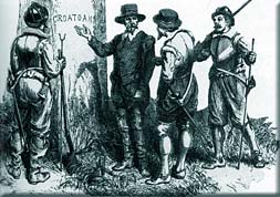
Where did Sir Walter Raleigh's colonists go?
If the colonists had left this message, their fate would not be a mystery.
Epilogue
Spain finished its active role in North America with an expedition from Mexico, which conquered the pueblos on the upper Rio Grande. In 1598 Spain organized this area into an isolated province named New Mexico (more than 400 miles of unorganized territory separated New Mexico from the nearest part of Old Mexico).
In 1600 a French fur trader founded an outpost named Tadoussac, on the Lower St. Lawrence River. In 1604 two French explorers, Samuel de Champlain and Pierre du Guast, the Sieur de Monts, founded an outpost in the Bay of Fundy, at Ile Ste-Croix (on Maine's side of the present-day US-Canadian frontier). This outpost had a military purpose, rather than a commercial one--to keep other Europeans from getting too close to the area that was now turning a profit for the French. They quickly learned how cold a Maine winter can get, and 35 of the 79 colonists died. When the weather warmed up the survivors moved to Port Royal, on the other side of the bay. Here they also had a tough time, but the outpost survived long enough to be considered a success, allowing France to claim the entire peninsula on the east side of the Bay of Fundy (present-day Nova Scotia, the French called it Acadia). A few more French citizens worked on Sable Island, an island surrounded by sand bars, ninety miles east of Nova Scotia; they serviced the ships that came for the fur trade.
As the sixteenth century ended, the real mover and shaker in the exploration business was an English writer, Richard Hakluyt (c. 1552-1616). In the 1580s and 1590s, he wrote several exciting books, describing the adventures of the explorers who had done so much to push back the world's frontiers. Whenever possible Hakluyt used eyewitness accounts, and he translated the stories of non-English explorers like Hernando de Soto, but his main interest was in the explorers from England, especially John Hawkins, Sir Walter Raleigh and Sir Francis Drake. Thus, he argued that the English race ought to settle the unoccupied parts of North America, and he is responsible, more than anyone else, in keeping England interested in Virginia until a successful colony could be established there.
Letting economics finance future exploration, rather than the government or wealthy individuals like Raleigh, the English now floated two companies, the Virginia Company and the Plymouth Company, to exploit North America. A few years earlier, the Dutch had shown that when several people pool their resources and agree to share the rewards from a venture, the risk to each member is reduced as well. Their expeditions (to the Spice Islands of Indonesia) brought back a profit quickly, so the English now felt that corporations were the way to pay for ships and crewmen. Anyway, the Virginia Company's charter allowed it to colonize any spot on the Atlantic coast, from Cape Fear to New York Harbor. In 1602 one of the Virginia Company's founders, an English lawyer and privateer named Bartholomew Gosnold, took a small ship, the Concord, and 32 colonists, to make a second attempt at settling Virginia. When he got to the other side of the Atlantic, Gosnold was considerably farther north than where he wanted to be; he made landfall at Cape Elizabeth, in Maine. Sailing south from there, he gave Cape Cod its name, discovered Martha's Vineyard (and named it after his daughter), and finally chose Cuttyhunk Island (then known as Elizabeth's Island), another island off the coast of Massachusetts, as the place for his outpost. However, the settlers did not stay long, and returned to England when they realized that they did not have enough supplies to make it through the winter. Not willing to give up, Gosnold then began calling for another colonization attempt; Jamestown would be his idea.
As for the Plymouth Company, it got a charter to settle the North American coast north of New York Harbor; like the Virginia Company, it claimed the continent's interior at the same latitude as its coastal claim, going all the way to the Pacific (this was called a "sea to sea" claim). In 1607 the Plymouth Company sent George Popham and Raleigh Gilbert to found a colony at the mouth of the Kennebec River. Because Maine was at the same latitude as England, the Company, not knowing anything about how ocean currents affect climate, thought Maine would have temperate, English-style weather. Instead, everybody perished from another Maine winter. As a result, the other colony founded in the same year, Jamestown, would be remembered, while Popham's colony is now all but forgotten.
Modern historians now believe that Don Luis de Velasco was none other than Opechancanough, a half-brother of the famous Powhatan whose long name meant "he whose soul is white." In 1622 and 1644 Opechancanough led the two Indian uprisings that nearly destroyed England's Virginia colony. At the time of the second attack, the chief was about 100 years old, and after it failed he was shot in the back while being held prisoner in Jamestown. The idea that he had traveled with--and fought--Spaniards in an earlier generation, helps to explain how he knew so much about his European opponents.
After Santa Elena's abandonment, some Spanish missionaries remained active in Georgia and the Carolinas. Gradually Franciscans replaced the Jesuits, and their missions grew to number more than 50. The most important of these, Santa Catalina de Guale, was located on St. Catherine's, an offshore Georgia island. They continued their efforts until 1680, when 300 pro-English Yamasee Indians destroyed St. Catherine's in a hail of fire and arrows. By this time English settlers had founded Charleston, and the disappearance of the missionaries allowed them to move into Georgia without Spanish resistance a few years later.
One more ironic story remains. In 1611 a Spanish ship sailed into Chesapeake Bay to spy on England's Virginia activities, claiming that it was searching for a lost ship. It captured and took an English pilot named John Clark to Spain, while three of its crewmen were stranded ashore and jailed by the English. One starved to death, while the second, an Englishman, was hanged for treason. The third, Don Diego de Molina, was released five years later. As for John Clark, he was also eventually returned to his native land, but he preferred the sailor's life, so he found the kind of work he wanted, as first mate on another ship bound for America. That ship was the Mayflower.
This is the End of Chapter 1.
FOOTNOTES
23. Two hundred years after its writing, The Travels of Marco Polo was still the only reliable guide to Asia that Europeans had. Consequently they did not know that the Ming emperors had expelled the descendants of Kublai Khan from China.
24. Ponce de Leon may have been on to something, nonetheless. Nowadays thousands of senior citizens retire to Florida every year, as if they want to find what de Leon missed.
25. Sebastian Cabot came this way in 1526. This time he was working for Spain, and seeking a "Southwest Passage" more convenient than the one Magellan found. He retraced Magellan's route as far as the Rio de la Plata before he decided to turn back and let Spanish sailors suffer instead.
26. A few years ago, The New York Times introduced the "1619 Project," which asserts that the most important event in early American history was the introduction of black slaves to Virginia, in 1619. As you can now see, the premise for the 1619 Project is false. All European countries that were active in the New World practiced slavery in the 16th-17th centuries, and Spain had slaves at San Miguel de Gualdape, nearly a century before they arrived in any English colony. I don't have any information on what happened to the slaves after they destroyed that colony. My guess is that those who lived long enough to meet the Indians would join their tribes, especially the Yamasee (a tribe in coastal Georgia, see also Footnote #25 in Chapter 2). Later on, the Spanish outposts of Santa Elena and St. Augustine would have slaves, too. In addition, we have a report from 1603 of seven or eight slaves escaping St. Augustine and fleeing south, to join the Ais, a small Indian tribe living at Cape Canaveral. Finally, a free black community eventually appeared in Spanish Florida; in 1693 the governor offered freedom to any slave who became a Catholic and served in the army for four years.
27. De Soto described Florida as "a land full of bogs and poisonous fruits, barren and the very worst country that is warmed by the sun."
One consequence of the de Soto expedition was that the pigs brought by the Spaniards for food escaped at Tampa Bay. Today 9 million feral hogs descended from those pigs roam wild in 39 states. The US Department of Agriculture estimates the hogs cause $2.5 billion in property damage each year, even though many Americans hunt them.
28. One day when Cartier was standing outside Stadacona, he asked the sons of Donnacona what they call their land, and they answered "k'anata." This is an Iroquoian word that simply means "village." Cartier heard "Canada." Apparently the Indians only applied the name to Stadacona itself, but Cartier misundertstood, and he used the name for Stadacona, the surrounding land, and the St. Lawrence River, which he called the rivi�re de Canada. By 1545, European books and maps were calling Cartier's colony Canada as well. So the second largest country in today's world got its name from a misunderstanding! As for Quebec, its name comes from Kebec, an Algonquin word meaning "where the river narrows."
29. The historical record does not tell us if Barre met Jean Ribault in the Tower; if he did, one can imagine how astonished both would have been.
30. Menendez celebrated his safe arrival at St. Augustine by holding a Thanksgiving Mass, and he invited the local Timucua Indians to the feast that followed. So this was the real first Thanksgiving dinner, fifty-six years before the Pilgrims had theirs (see the next chapter). However, in the Florida wilderness, turkey and pumpkin pie weren't on the menu; according to the ship's log, the Spaniards ate a stew of pork, garbanzo beans and onions most of the time, so this was probably the main course. The Timucua lived by fishing, so they brought fish and clams to the event. This story was rediscovered by a University of Florida history professor, Michael Gannon, and he casually mentioned it in a 1965 book, The Cross in the Sand. Twenty years later Gannon compared the age of the Florida and Massachusetts colonies with this remark: "In the year 1621, when the Pilgrims were having their first Thanksgiving, St. Augustine was up for urban renewal."
31. It is also possible that a hurricane wiped out the colony. Roanoke island is in a vulnerable location for summer and winter storms, and barely above sea level, so one 15 to 20-ft. surge of the waves could have done the job.
Support this site!
![]()
PAGE NAVIGATOR
The Anglo-American Adventure
|
Other History Papers |
Beyond History
|